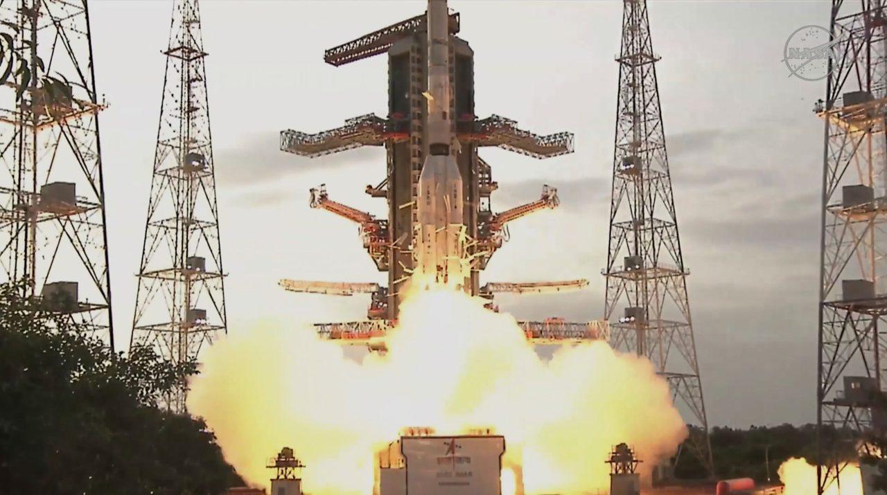
Nasa and India have teamed up to launch an Earth-mapping satellite capable of tracking the slightest shifts in land and ice.
The $1.3bn (£980m) mission will help forecasters and first responders stay one step ahead of floods, landslides, volcanic eruptions and other disasters, according to scientists.
Rocketing to orbit from India, the satellite will survey virtually all of Earth’s terrain multiple times. Its two radars – one from the US and the other from India – will operate day and night, peering through clouds, rain and foliage to collect troves of data in extraordinary detail.
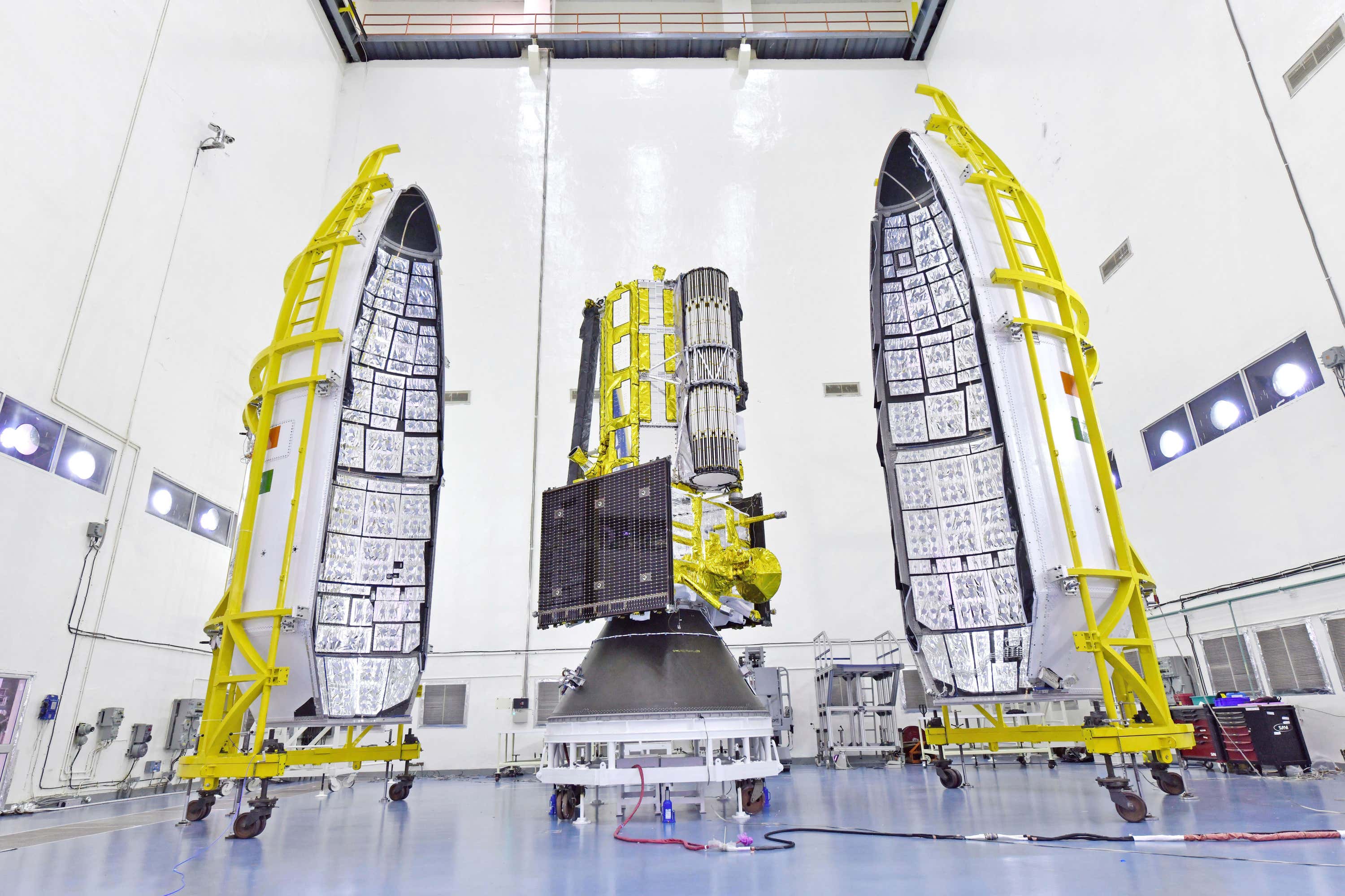
Microwave signals beamed down to Earth from the dual radars will bounce back up to the satellite’s super-sized antenna reflector perched at the end of a boom like a beach umbrella.
Scientists will compare the incoming and outgoing signals as the spacecraft passes over the same locations twice every 12 days, teasing out changes as small as a fraction of an inch.
It’s “a first-of-its-kind, jewel radar satellite that will change the way we study our home planet and better predict a natural disaster before it strikes,” Nasa’s science mission chief Nicky Fox said ahead of liftoff.
Ms Fox led a small Nasa delegation to India for the launch.
 PA Media
“Congratulations India!” minister of science and technology Jitendra Singh posted once the satellite safely reached orbit, adding that the mission “will benefit the entire world community”.
Nasa’s deputy associate administrator Casey Swails, part of the delegation that travelled to India, said it “really shows the world what our two nations can do. But more so than that, it really is a pathfinder for the relationship building”.
It will take a week to extend the satellite’s 30ft boom and open the 39ft-in-diameter drum-shaped reflector made of gold-plated wire mesh. Science operations should begin by the end of October.
Among the satellite’s most pressing measurements: melting glaciers and polar ice sheets; shifting groundwater supplies; motion and stress of land surfaces prompting landslides and earthquakes; and forest and wetland disruptions boosting carbon dioxide and methane emissions.
Nasa is contributing $1.2bn (£900m) to the three-year mission – it supplied the low-frequency radar and reflector.
The Indian Space Research Organisation’s $91m (£68m) share includes the higher-frequency radar and main satellite structure, as well as the launch from a barrier island in the Bay of Bengal. It is the biggest space collaboration between the two countries.
The satellite called Nisar – short for Nasa-Isro Synthetic Aperture Radar – will operate from a near-polar-circling orbit 464 miles high. It will join dozens of Earth observation missions already in operation by the US and India.
Follow STV News on WhatsApp
Scan the QR code on your mobile device for all the latest news from around the country