ITV News Science Correspondent Martin Stew explains what is behind the extreme conditions causing unprecedented wildfires in Europe, and ITV Weather Presenter Becky Mantin explains the patterns fuelling them
Words by Jamel Smith, Producer
France and Spain have been battling unprecedented wildfires over the past week, forcing about 325,000 people to evacuate.
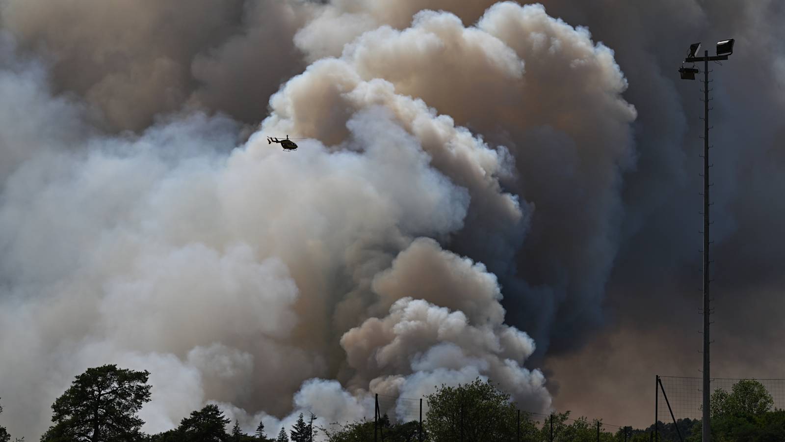
The fires are some of the most extreme Europe has suffered. Such is their intensity – fires in France have been described as atomic in their power – that they have created their own weather systems known as pyrocumulonimbus – or fire cloud.
Experts say this is the first time these massive thunderstorm clouds have been seen in France.
Víctor Resco de Dios, a lecturer in Forestry Engineering and Global Change at the University of Lleida and researcher at Agrotecnio, said: “We have entered an era of fires that cannot be extinguished. These are fires that burn with the intensity of several atomic bombs and, as such, putting them out is extremely complex.”
Here’s what you need to know about pyrocumulonimbus.
What is a fire cloud?
Fire clouds, also known as pyrocumulonimbus (pyroCb) clouds, are extremely powerful fire-generated thunderstorms.
“It develops when an intense wildfire releases enough heat to generate a rapidly rising column of hot air, smoke and moisture. If the atmosphere is sufficiently unstable, this plume can grow into a fully developed thunderstorm cloud,” Dr Francesca Di Giuseppe, Fire Forecast Coordinator at the European Centre for Medium-Range Weather Forecasts (ECMWF), said.
“The formation of a pyrocumulonimbus indicates that the fire is interacting strongly with the atmosphere and has begun to generate its own weather,” she continued.
The smoke plumes that form a fire cloud can reach altitudes of 10 to 15 kilometres (six to nine miles), penetrating the stratosphere.
Nasa has even described the plumes as the “fire-breathing dragon of clouds”.
How dangerous is a fire cloud?
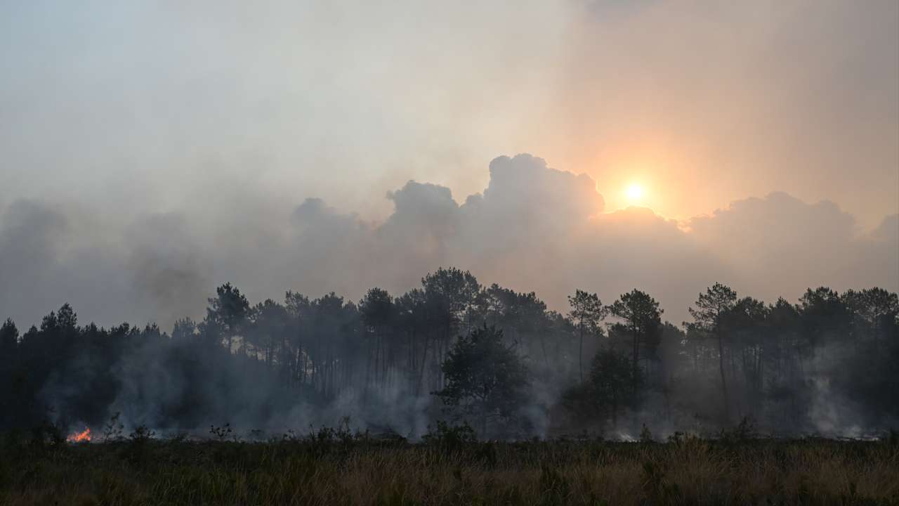
Fire clouds can make wildfires significantly more unpredictable and dangerous.
These storms can produce powerful and erratic winds, intense downdrafts and lightning strikes, making fire behaviour highly unpredictable and posing a serious risk to firefighters and nearby communities, according to Dr Giuseppe.
“In some cases, pyrocumulonimbus events can inject smoke into the upper troposphere or even the lower stratosphere, reaching altitudes comparable to those associated with a moderate volcanic eruption,” Dr Giuseppe said.
They have also been linked to the formation of dangerous fire tornadoes.
Can they produce rain?
Yes, fire clouds can produce rain, but the hot, dry air beneath them often causes raindrops to evaporate before they reach the ground – a phenomenon known as virga.
ITV Weather Presenter Becky Mantin said this can create the risk of dry lightning, where lightning strikes occur with little or no rainfall.
This can make wildfires even more dangerous, as lightning can ignite new fires while the lack of rain means the ground remains dry.
Has this happened before?
Fire clouds are well documented in Australia, Canada and the western United States, where they are associated with some of the most extreme wildfires, Dr Giuseppe said.
They remain relatively rare in Europe.
However, the Royal Meteorological Society warned that as the climate changes, these unusual but significant storms could become more frequent as hotter and drier conditions increase the risk of wildfires.
Do fire thunderstorms happen in the UK?
There are no confirmed cases of a fire thunderstorm developing over a UK wildfire, according to ITV’s Becky Mantin.
However, the UK has experienced several pyrocumulus clouds, which form through a similar process but do not develop into thunderstorms.
They have been observed above wildfires, including the Saddleworth Moor and Winter Hill fires in 2018, the Wareham Forest fire in 2020, and several blazes during the 2022 UK heatwave.
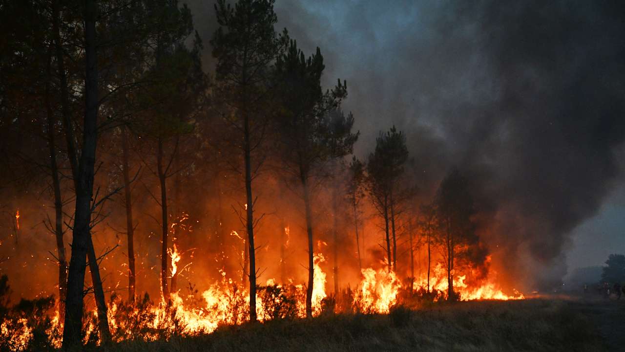
The ingredients needed for a fire thunderstorm are:
- An exceptionally intense wildfire
- A deeply unstable atmosphere
- Sufficient moisture higher in the atmosphere
The UK rarely experiences all three conditions at the same time.
Wildfires in Britain are generally smaller than those in major fire-prone regions, vegetation is often less dry, and the country’s maritime climate tends to create a more stable atmosphere that limits explosive cloud growth.
Could the UK see one in the future?
Possibly. Hotter, drier summers are increasing the risk of larger vegetation fires across the UK, Mantin said.
If a major wildfire occurred alongside the right atmospheric conditions, a fire thunderstorm could develop.
It would still be exceptionally rare, but meteorologists believe the possibility is becoming more plausible as the climate warms.
Follow STV News on WhatsApp
Scan the QR code on your mobile device for all the latest news from around the country