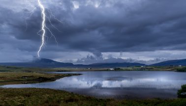
A further warning for thunderstorms has been issued, with adverse weather likely to be more widespread than it has been in recent days.
The downpours are expected to develop across central Scotland on Friday afternoon and evening, encompassing parts of West Lothian and Falkirk to North Lanarkshire, Glasgow, Renfrewshire and Inverclyde.
The Met Office has a yellow warning in place from 4pm until 11.59pm, with a risk of spray and flooding – which could cause difficult driving conditions and delays for public transport.
STV meteorologist Sean Batty has told people in parts of the country they should expect “heavier bursts with up to 30-40mm of rain falling in just an hour or two”.
He explained: “Over the last few days we’ve been putting out warnings for thunderstorms, but many of you may not have had anything.
“Thunderstorms are usually only several miles wide and therefore only affect small areas, but where they do occur can cause some flooding.
“That means where there have been warnings in previous days and you’ve not had a storm, the forecast was not wrong, you’ve just been lucky that you dodged them.
“A further warning been issued for thunderstorms for Friday evening, but this time it’s likely to be more widespread than recent events and become a large area of rain with thundery downpours.
“This will develop late Friday afternoon and evening across central Scotland, with places like Livingston, Falkirk, Stirling, Lanark, Cumbernauld, Aberfoyle, Loch Lomond, Glasgow, Paisley, Greenock and Dumbarton at risk of getting some of the heaviest bursts.
“It’s here there could be some of the heavier bursts with up to 30-40mm of rain falling in just an hour or two, which drains may struggle in built up areas and therefore lead to some flooding on roads.
“These areas normally only get about 50-70mm of rain throughout the whole of June, so that gives you an idea of how heavy some of the downpours could be.”
Further into the evening the rain is expected to move north on the west of Scotland.
Sean added: “Later in the night the heaviest rain will then spread north on the western side of the country across Stirlingshire, mainland Argyll and then into Lochaber.
“Again in these areas there could be up to 40mm of rain in an hour. After midnight the intensity of the rain should ease as it continues to move north into the west Highlands.
“It’s also likely there will be some rumbles of thunder and the risk of some hail in the heavier downpours.
“The weather will be quieter on Saturday with a lot of dry and sunny weather, before gales and rain move into the west later.”
Follow STV News on WhatsApp
Scan the QR code on your mobile device for all the latest news from around the country


