 Getty Images
I’m writing this on the back of several people coming up to me and asking if the super El Niño is something we should be frightened of?
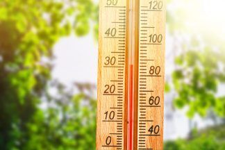
First of all, it is a significant event and will have big impacts around the world and there no doubt will be news stories in the coming months which will be linked to the excessive warmth in the Pacific.
In a way because this El Niño is going to be record-breaking – it’s going to take us into uncharted waters (excuse the pun) but we already do know what previous El Niños have brought globally and may point to a worse version of that in the coming months.
EL NIÑO IS NOT SOMETHING NEW
First thing I think we need to address is El Niño is normal and not some new scary phenomenon as some media would lead you to believe when you look at the headlines.
In fact it was first documented in the 1600s when fishermen off the west coast of South America noticed the occasional warming of the ocean in which they fished, with temperatures generally peaking around Christmas time – hence the name El Niño – which means baby boy (or Christ in the context of Christmas).
WHAT DOES IT DO?
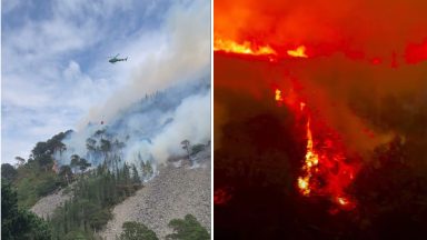
Well, El Niño brings variations of extremes around the world – with most of these seen across South America, Africa, southeast Asia and Australia.
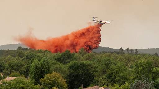
One positive is usually less hurricanes in the Atlantic, but southern Africa can experience severe droughts and famine, droughts in Australia and floods in Chile and Argentina. Much warmer conditions can also be seen in Asia as well as southern Australia and western Canada.
Now, I like to think of El Niño as being a bit like dropping a stone into a puddle – it has consequences around the world as the ripple moves outwards – although it’s more muted further away. So for Europe it’s far from clear cut in what it means for us here and certainly for Scotland – but let’s have a go at it…
There have been eight strong El Niños since 1965, now because they tend to peak around Christmas we would most likely be looking to see if they have any influence on our winters and springs here in Scotland – so here’s what I’ve found.
EL NIÑO’S INFLUENCE IN SCOTLAND
Now because El Niño tends to peak in our winter, it’s around then that we’re likely to see the biggest influence, if any – so we’ll look at winter and spring.
It’s important to note that every El Niño event has its own unique footprint, so no two are ever exactly the same. Even so, after looking through several of the strongest events, a few interesting patterns do begin to emerge.
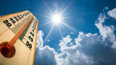
When it comes to temperature, Januarys during El Niño years tend to be fairly average overall.
February is more complicated: three of the eight El Niño Februarys I examined were colder than average, but just as I thought I had identified a trend, February 1998 turned out to be Scotland’s warmest February on record.
March shows a clearer signal, with seven of the eight years being warmer than average, while March 1998 ranks among the 30 warmest Marches on record.
The most consistent pattern appears in April. Six of the eight El Niño years I analysed produced average to colder than average Aprils.
In fact, April 1983 and April 1966 rank as Scotland’s 8th and 5th coldest Aprils respectively, making this by far the strongest temperature signal in the data.
Interestingly, when it comes to May, the last five during an El Niño have brought us much warmer weather. May 1992 was our 6th warmest and May 2024 was our warmest on record – quite the turnaround from the colder trend for April.
Rainfall signals are even less straightforward. January shows a split between very wet and relatively dry months. February and March display no obvious pattern at all.
However, April and May do show a slight tendency towards average or above-average rainfall. Notably, April 1998 and May 1966 both rank among the 25 wettest on record, and April 2024 was the 6th wettest on record.
WHAT DOES THIS MEAN FOR WINTER 26/27?
Taking these trends into account, the prospect of another strong or even “super” El Niño suggests the possibility of a colder-than-average end to winter and start to spring.
If that were to occur, it could have implications for the 2027 lambing season and for early spring vegetation, particularly if mild conditions in March encourage flowers and plants into early growth before colder weather returns in April.
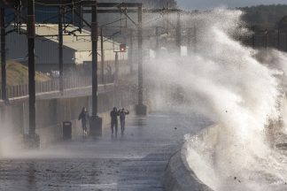
Rainfall remains much harder to predict. However, two of the strongest El Niño events – 1982/83 and 2015/16 – were associated with exceptionally wet Januarys.
That raises the possibility of a particularly wet start to next year, while spring as a whole may lean slightly wetter than average based on the historical evidence available.
But remember, this El Niño is likely to blow the others out of the water. What that will mean for our trends, we’ll need to wait and see. I suppose the things I’ll be looking for are whether January 2027 ends up being one of our wettest on record, and whether we’ll see much colder and snowier weather around Easter next year.
One thing is for sure – this El Niño will bring some big headlines from the around the world once it properly kicks in later this year for the southern hemisphere’s summer and our winter in the north.
Follow STV News on WhatsApp
Scan the QR code on your mobile device for all the latest news from around the country