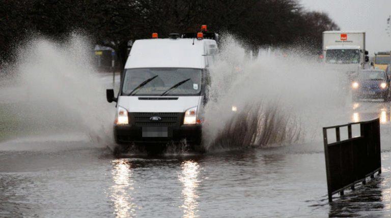
A weather warning has been issued for Orkney and Shetland with flooding and travel disruption expected.
The Met Office confirmed a yellow warning for heavy rain which poses a risk of flooding and disruption to travel is in place for the islands from 3am on Tuesday until around 8pm.
As much as 80mm of rain could fall across parts of Shetland, with totals of 20-40mm expected to fall widely within a six to twelve hour period on Tuesday.
Flooding of homes and business is possible said forecasters, and strong winds are expected to accompany the rain bringing disruption to travel.
Network Rail said services may be impacted and that residents with garden furniture near the West Highland Line and Kyle Line are being asked to ensure they are secured.
A Network Rail post read: “We’ll also see heavy rain, with the West Highland Line and Kyle Line expected to see up to 30mm tomorrow.
“With the dry weather we’ve seen over the last few days, it’s unlikely we’ll need to slow trains down, but we’ll be keeping an eye on this.
“One other point about the dry (and sunny) weather, is that we know many will have dusted off the patio furniture while the sun’s been out.
“If you live next to the railway, we’re asking you to help us keep trains running by securing garden furniture, trampolines etc today.
“Our teams are preparing for the strong winds, with chainsaw teams being readied, and pumps for potential flooding being loaded into vehicles.
“We’re ready to deal with any debris on the tracks or any fallen trees.”

Insight Sean Batty STV News Meteorologist
After a weekend with plenty of summer warmth in the west, the handbrake has been applied and this week we’ll be plunged into autumnal conditions with mountain snow and overnight frosts.
Although snow in the mountains and frosts are nothing unusual as we head into autumn I’d say this is a bit earlier than we’d normally expect and it’s quite a dramatic gear change from what we’ve had recently.
Shetland and Orkney face particularly harsh weather on Tuesday, with strong winds and heavy rain in the forecast. A band of heavy rain could linger over the Northern Isles, potentially dropping around 50mm — roughly half a month’s worth of rain.
This could lead to local flooding and hazardous road conditions. Winds could gust between 60-70 mph in some areas, though the strongest winds are likely to remain offshore, with a slight chance of stronger gusts briefly affecting eastern Orkney.
Caithness, along with the Moray and North Aberdeenshire coasts, will also see strong winds on Tuesday morning, with gusts similar to those in the Northern Isles. Buchan is the area most likely to experience the strongest gusts.
Elsewhere across the country, Tuesday will be a windy day with frequent showers, particularly in the north and west. It will feel significantly cooler, especially in the Hebrides and Argyll and Bute, where temperatures will be around 12°C—quite a contrast from the weekend’s warmth.
The south and east, including areas like Perthshire, Fife, Edinburgh, the Lothians, Lanarkshire, and Glasgow, will see fewer showers by Wednesday and Thursday. However, clearer skies will bring chillier nights, with the possibility of frost in more rural areas.
Mountain summits, like Cairn Gorm and Ben Nevis, will experience freezing temperatures most of the week, with wintry showers and strong winds.
Temperatures will recover later in the week, reaching the mid to high teens by the weekend, though there may be another dip in temperatures later on.
Follow STV News on WhatsApp
Scan the QR code on your mobile device for all the latest news from around the country