
Key Points
-
 Storm Austen to hit UK on Friday with heavy rain for much of Scotland
- Road closed in Shetland due to landslide
- Storm Boelo amber warning now issued with ‘danger to life’
- 24 hours of winds up to 80mph forecast this weekend
- First and second named storms of the season hit UK in space of two days
The first of two named storms in two days has hit the UK, with Scotland being battered by heavy rain and strong gusts.
Storm Austen strikes the UK on Friday, with the Met Office upgrading the yellow warning for Storm Boelo to an amber “danger to life” alert.
The first warning for heavy rain came into force for central, southern and north-east Scotland at 6am on Friday and will run until midnight.
An area of heavy rain will develop across southern and central areas of Scotland before dawn on Friday, extending over north-east Scotland during the morning and early afternoon.
The Met Office says accumulations of 20-40mm are expected widely within the warning area through this period, with 60-80mm possible in some locations.


Forecasters are warning of a small chance that homes and businesses could be flooded, causing damage to some buildings.
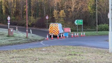
Police Scotland confirmed the B9071 is closed between Garderhouse and the Reawick junction in Skeld, Shetland, following a landslide. Drivers are urged to avoid the area.
Network Rail implemented speed restrictions on major routes to and from Aberdeen, between Glasgow Central and Carlisle and between Glasgow Central and Edinburgh Waverley.
A number of ferry services were cancelled on Friday, with all sailings between Largs and Cumbrae cancelled and disruption to routes in Mallaig and Lochaline.
The Scottish Environment Protection Agency (Sepa) has 11 flood alerts in place in the same areas where the Met Office’s yellow warning is in place.
What will Storm Boelo bring this weekend?
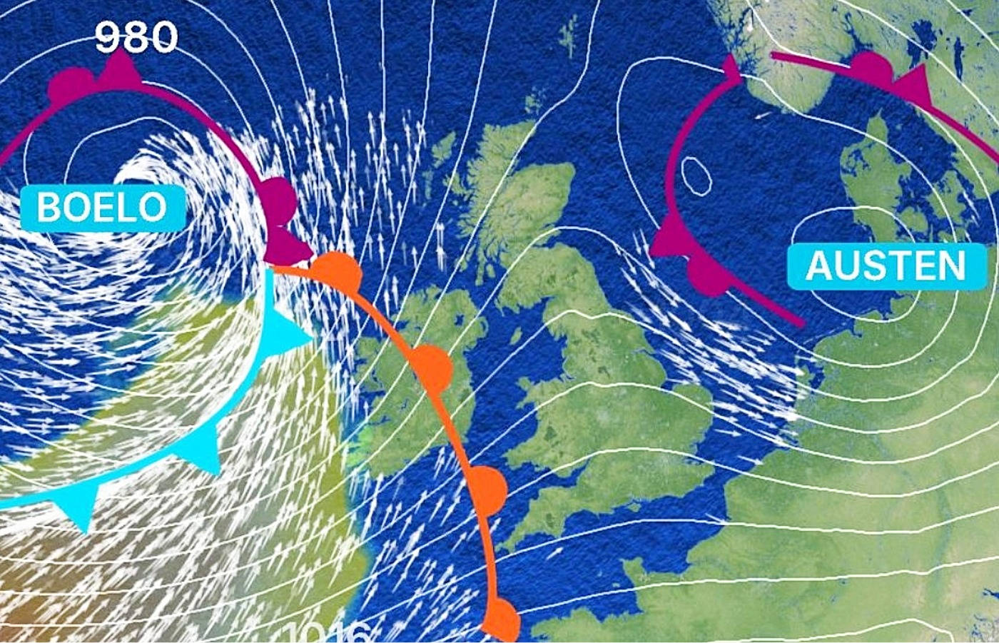
An amber alert for wind will be in force between 9pm on Saturday and 9pm on Sunday as Storm Boelo sweeps across the whole of mainland Scotland.
That is additional to the yellow warning for winds between noon on Saturday and Sunday evening, which covers all of Scotland.
 STV News
Some damage to buildings and trees, such as tiles blown from roofs and large branches or trees blown over, could happen, the Met Office said.
Disruption is expected on road, rail, air and ferry services, with fairly widespread gusts of 60 to 70 mph and gusts to 80 mph in exposed coastal areas.
The strongest winds will initially affect western Scotland and far north of Northern Ireland on Saturday evening and then spread eastwards overnight and through Sunday


Areas affected by yellow weather warning on Friday
- Angus
- Clackmannanshire
- Dundee
- Falkirk
- Fife
- Perth and Kinross
- Stirling
- Aberdeen
- Aberdeenshire
- Moray
- East Ayrshire
- East Dunbartonshire
- East Renfrewshire
- Glasgow
- North Ayrshire
- North Lanarkshire
- Renfrewshire
- South Ayrshire
- South Lanarkshire
- West Dunbartonshire
- Dumfries and Galloway
- East Lothian
- Edinburgh
- Midlothian Council
- Scottish Borders
- West Lothian
What do the storms mean for Scotland?

Insight Philip Petrie STV News weather presenter
Storm Boelo looks set to bring heavy bursts of rain, particularly over higher ground, with further heavy showers and rain constantly wrapping around the centre of the storm and moving west to east across the country.
The winds associated with Storm Boelo are the most concerning part.
We currently have a yellow weather warning covering the whole of Scotland from 6pm Saturday until 9pm Sunday where widely we could see gusts of 55-60mph and some higher ground areas and coastal parts seeing gusts of 80mph.
Storm Boelo will move away finally overnight Sunday into Monday, when we start to see the winds easing and dying out.
Follow STV News on WhatsApp
Scan the QR code on your mobile device for all the latest news from around the country