Latest updates
-
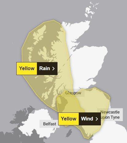
 Met Office weather warnings are in force from 11am on Wednesday until 9am on Thursday
 - Remnants of Hurricane Ernesto, which ripped through the North Atlantic last week, will play a role in the downpours and windy weather
- Some built-up areas will see 18 days’ worth of rain fall with 72 hours
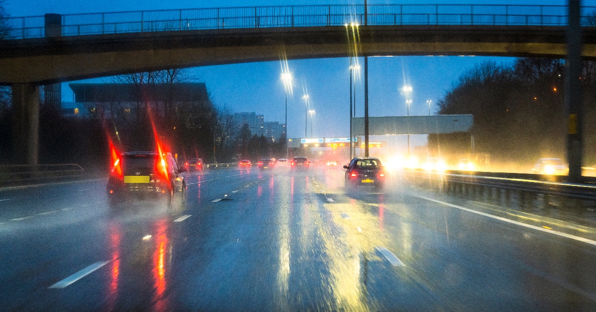
- Difficult driving conditions, travel disruption, and flooding is forecast
- The entire west of Scotland is expected to be impacted
- The Scottish Environment Protection Agency has issued 12 flood warnings and 14 flood alerts.
Weeks’ worth of rain and strong winds with gusts of up to 60mph are set to bring “dangerous conditions” and travel disruption to parts of Scotland.
A Met Office yellow weather warning for rain covering the west of the country is in force from 11am on Wednesday. A wind alert comes into effect at 1am on Thursday.
The windy weather could accompany up to 150mm of rainfall within 24 hours in some areas.
Areas affected by heavy rain – including Glasgow, Ayrshire and other places in western Scotland – are likely to see 75-100mm of rainfall over the course of Wednesday and Thursday, though more is forecast over higher ground.
 Met Office
This could cause difficult driving conditions, travel disruption, and flooding in places. The Scottish Environment Protection Agency has issued 12 flood warnings and 14 flood alerts.
The Met Office said remnants of Hurricane Ernesto, which ripped through the North Atlantic last week, will play a “background role” in the downpours and windy weather.
The weather will be sunny with scattered showers for most of the UK on Tuesday, with heavier rain and stronger winds in the north-west.

Insight Sean Batty
Weather charts at the moment definitely don’t look like August – more like October with deep low pressure systems barrelling in from the Atlantic bringing strong winds and heavy rain.
The remnants of Hurricane Ernesto will bring a huge amount of rainfall to the west of the country on Wednesday and Thursday with some spots possibly clocking up 150mm of rain.
The worst of the rain will be around Loch Shiel, Lochaber, Mull, Kintail, Knoydart and Skye, but as much as 60mm may also fall in the hillier parts of Renfrewshire, North Ayrshire and Inverclyde.
This means that some spots could get as much as two weeks’ worth of rain through Wednesday and Thursday.
Places around Clyde Muirshiel, such as Kilbirnie and Lochwinnoch have had around 40-50mm of rain since Monday, which means added on to what we will see in the coming days, could be going on for about a months’ worth of rain falling during this week – horrendous stuff for August.
The excessive amount of rain will lead to local flood issue on some roads with large pools of water developing, especially along hedgerows on country roads.
Gales will also develop around the Hebrides as well as the north and west coast, which means that some disruption to ferry journeys may be experienced. Tides are also particularly high just now which means large waves and water could affect some coastal routes.
While the worst of the rain clears away into Thursday, this will be followed on by blustery showers in the north and west of the country which will be still be heavy.
Follow STV News on WhatsApp
Scan the QR code on your mobile device for all the latest news from around the country