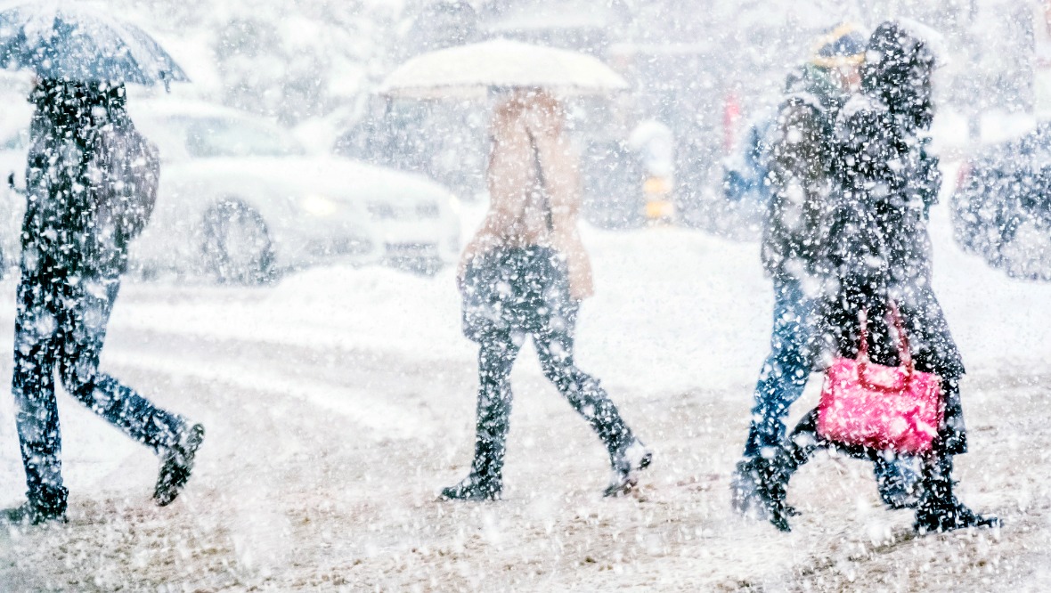
Snow and ice warnings are in force across Scotland with wintry weather throughout the week.
Frequent snow showers are expected from late on Tuesday through Wednesday and Thursday and may lead to disruption.
Overnight showers and low temperatures will bring the risk of ice, especially in the north.
There is a likelihood of some icy patches on untreated roads, pavements and cycle paths.
Snow is expected on hills above 300 metres, and there could be as much as 10cm of snow on high ground.
The public has been warned to take care in case of injuries from slips and falls on icy surfaces.
When and where will snow and ice hit Scotland?
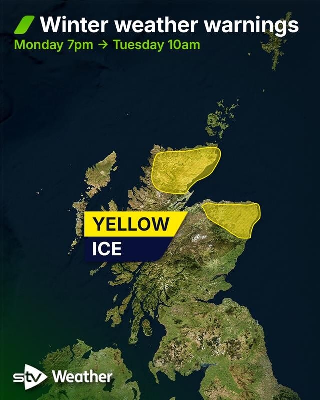
Yellow alerts for ice came into force at 7pm on Monday covering northern parts of the mainland.
 STV News
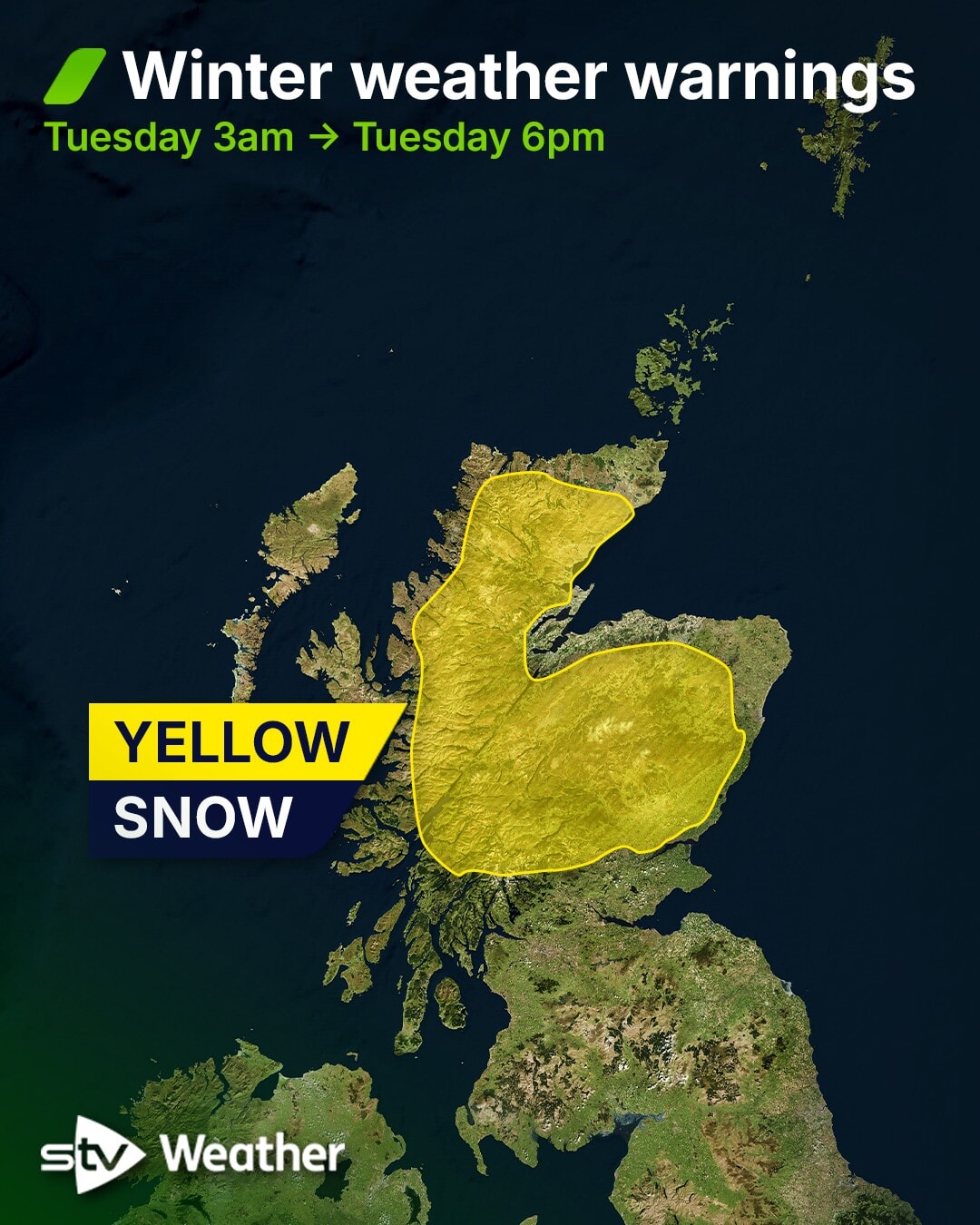
A snow warning came into force from 3am in effect north of Stirling.
 STV News
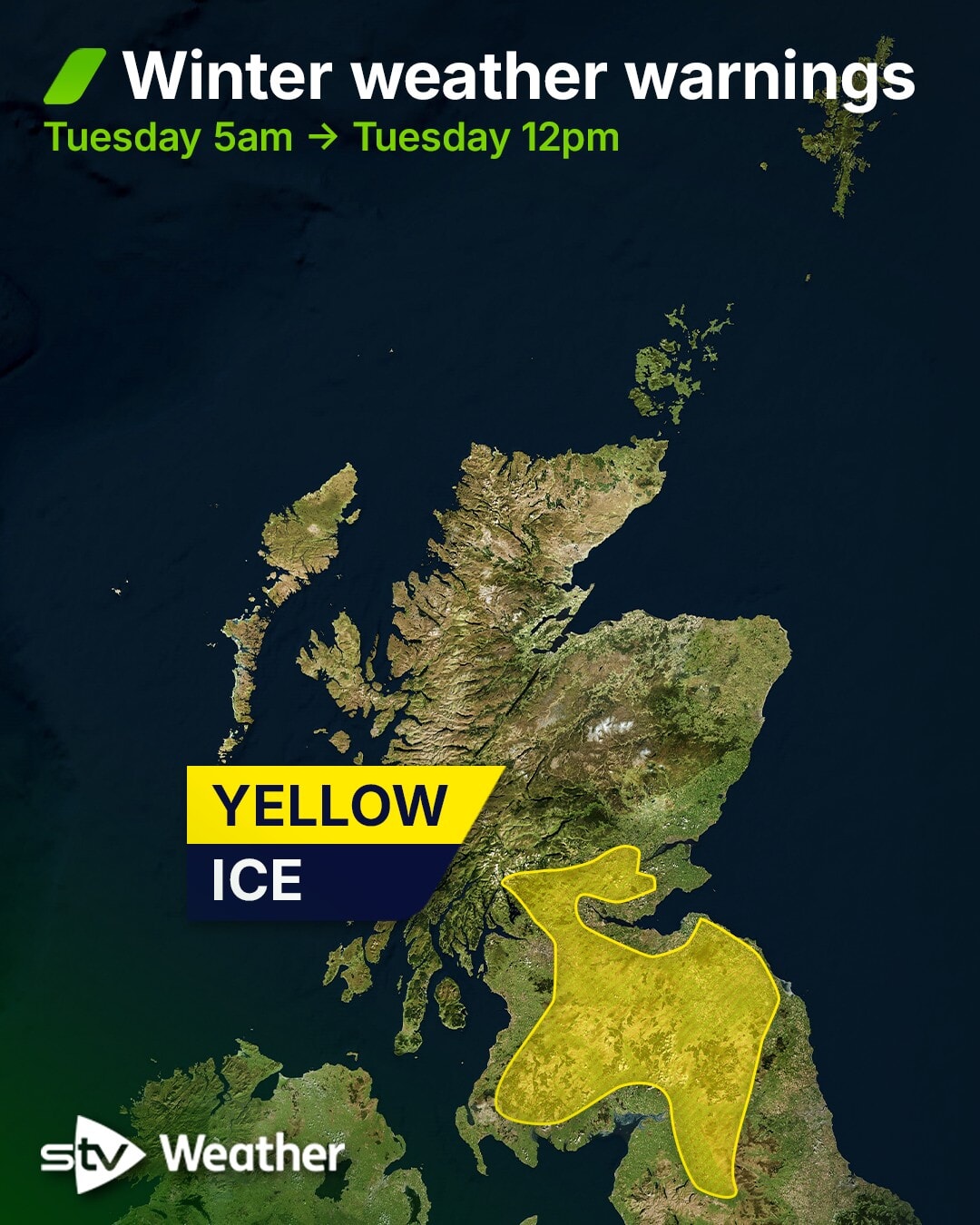
A further ice warning started from 5am on Tuesday, covering inland areas over the central belt and south of the country.
 STV News
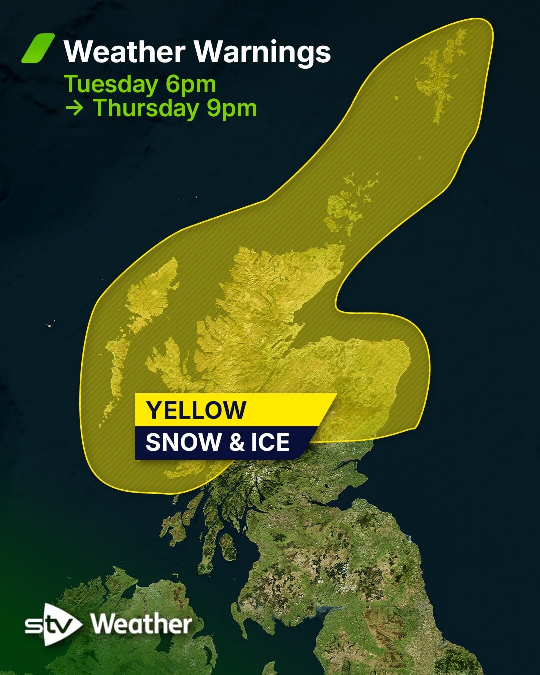
A snow and ice warning covering most of the mainland, the Hebrides, Orkney and Shetland comes into force at 6pm on Tuesday and is in effect until 9pm on Thursday.
On Tuesday, the Met Office updated a yellow warning for ice coming into effect from 4pm until 11am on Wednesday.
It covers the majority of the east and west of the country including Glasgow and Edinburgh, as well as the Borders and parts of Tayside.
 STV News
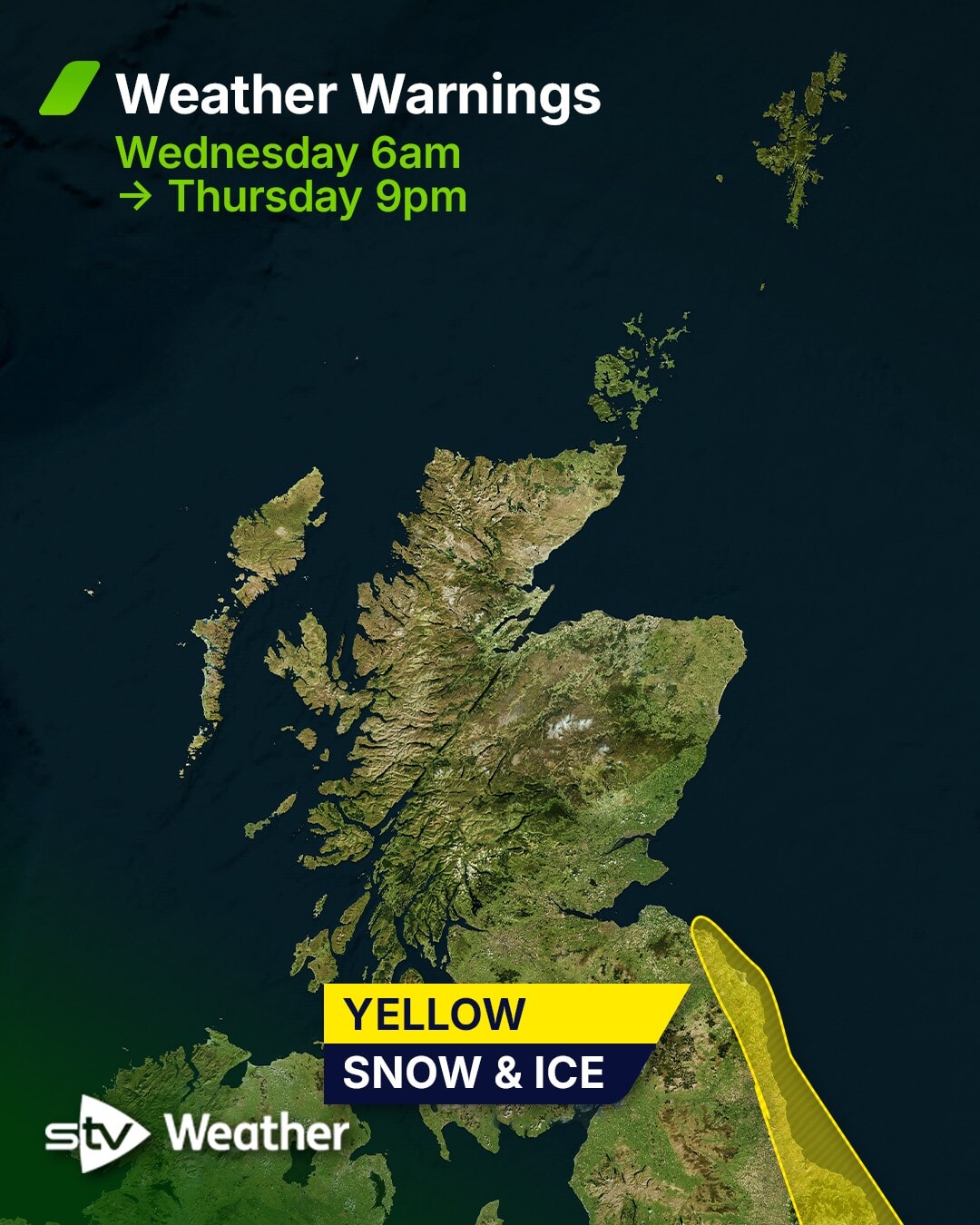
On Wednesday at 6am, a yellow warning for snow and ice on Scotland’s southeast coast comes into force and lasts until Thursday at 9pm.
 STV News
STV meteorologist Sean Batty has predicted that most towns and cities will see daytime temperatures around 4C or 5C through much of the week, with nights dipping to around freezing.

Insight Sean Batty STV News Meteorologist
The Northern Isles will see wintry showers from Monday and throughout the week, with some heavy snow showers likely on Tuesday, Wednesday and Thursday.
The most widespread spell of snow arrives on Tuesday as a band of rain and hill snow moves in from the west.
Low-lying areas of Ayrshire, Glasgow, Renfrewshire, Dunbartonshire and Argyll & Bute will mainly see rain and sleet.
Higher ground, including East Kilbride, Airdrie, Cumbernauld, Whitburn and Shotts, may see a short spell of snow before it turns to sleet.
Further east across Edinburgh and Fife, some snow will fall to lower levels, though it’s unlikely to stick; higher areas such as Balerno, Penicuik, Gorebridge and Kinross may see some lying snow.
The biggest accumulations will be across the higher parts of the Borders and the Highlands, where 5 to 10 cm is possible. Higher roads such as the A9, A95, A96, A68 and A7 could see several centimetres of snow settle during Tuesday afternoon and evening.
Once this messy mix clears on Tuesday evening, things become more straightforward.
Sunshine will develop across central and southern Scotland, while snow showers continue across the north on Wednesday and Thursday.
These will be heaviest in areas exposed to the northerly flow, including the Northern Isles, Western Isles, Skye, north Highlands, Moray and north Aberdeenshire. East Lothian and the coastal Borders may also catch some flakes – some significant accumulations may develop in some areas.
Follow STV News on WhatsApp
Scan the QR code on your mobile device for all the latest news from around the country