 STV News
Weather warnings have been issued for heavy rain as Storm Francis begins to sweep across the country.
The last named storm of the season brought gusts of more than 50mph to the UK overnight.
A yellow weather warning for rain has been put in place throughout Tuesday until 6am on Wednesday.
The downpour is expected to affect the central belt, southern and eastern parts of Scotland.
As well as Dumfries and Galloway and the Borders, warnings have also been issued across Ayrshire, Glasgow, Lanarkshire, Stirlingshire, Edinburgh, Fife, Tayside and parts of Aberdeenshire.
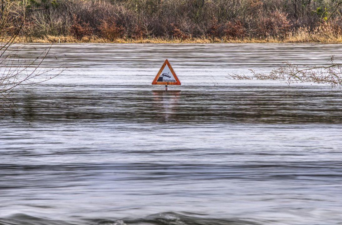
The Scottish Environmental Protection Agency (Sepa) has issued ten flood alerts covering the affected areas.
The Met Office is warning that the spray and flooding could also lead to difficult driving conditions and road closures with disruption to public transport.
ScotRail has advised passengers to check their journeys “before heading to the station”.
Dumfries and Galloway police has urged motorists to allow extra travel time for work and school journeys and to drive according to the conditions.
The adverse weather follows intense rainfall and thunderstorms earlier in August, which saw a major incident declared in Fife.
The downpour also caused a ScotRail passenger train to detail after it hit a landslip near Stonehaven in Aberdeenshire. Three men died and six were injured in the crash.
The Met Office has never had two named storms in August since the process started in 2015, but Francis comes on the back of Ellen which struck last week and caused power outages.
No new storm is currently forecast this month, meaning the next storm will begin with A rather than G, as the storm-naming calendar resets on September 1.
STV meteorologist Sean Batty expects to see around 20-30mm of rain, which is around a third of a month’s rainfall for some spots.
He added: “The strongest winds will occur late afternoon and into the evening with gusts up to 55mph possible along the east coast.
“While these winds are not overly strong for us, the time of year could make it a little more disruptive as trees are in full leaf and this means branches are heavier and act as sails meaning there is a greater risk of branches coming down.
“The weather will turn much quieter later in the week, but there will be a bit of an autumnal chill in the air as we head towards the start of meteorological autumn on Tuesday next week.”
Follow STV News on WhatsApp
Scan the QR code on your mobile device for all the latest news from around the country