 iStock
Two yellow weather warnings have been issued across as heavy downpours and thunderstorms are set to batter the country for the remainder of the bank holiday weekend.
Forecasters predict up to 20mm of rain could fall within an hour leading to travel disruption and flooding.
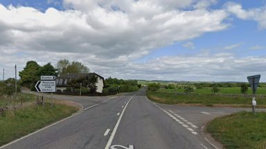
Slow-moving showers and thunderstorms are expected to develop during Sunday afternoon and evening, and a warning has been issued from 1pm until 11.59pm covering central and southern Scotland.
The Met Office warned of flooding to homes and roads and advised that travel disruption was likely, with bus and train services affected with longer journey times.
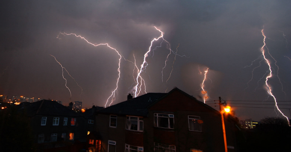
Thunderstorms are expected to rumble over the country on Monday as a second yellow weather warning has been issued from 11am until 10pm covering the east coast and Highlands.
Forecasters warned of lightning strikes and some areas seeing a chance of up to 40mm of rain in a couple of hours in some areas and flash flooding.
SEPA have issued 13 flood alerts across the country as it said surface water may cause flooding of low-lying land and roads, making driving conditions difficult.
The A83 Rest and Be Thankful will operate under convoy due to the heavy rain forecast and the measure will likely be in place until Monday, BEAR Scotland said.
Network Rail Scotland said its teams were on standby, checking pumps and making sure it was ready if the forecast deteriorated but added, no speed restrictions would be put in place immediately.
ScotRail added it was planning to run a normal timetable.

Insight Philip Petrie STV Weather Presenter
As we come out of a dreich and damp bank holiday weekend, the changeable and unsettled theme continues into the week unfortunately. Low pressure is dominating our weather for the rest of Sunday, pushing a frontal system across Scotland. Behind this frontal system we are influenced by an unstable and turbulent atmosphere which will lead to thunderstorms over the next couple of days.
Today we’re seeing a band of rain pushing north westwards through the Highlands, turning showery by the afternoon. Behind that however, some heavier showers start to push up from the Borders later in the afternoon and by around 6pm we will see showers developing quite widely. These showers have the potential to be very heavy, slow moving, with the risk of lightning and therefore the Met Office have issued a thunderstorm warning covering much of the southern half of Scotland.
It is expected we could see 15-20mm of rainfall within one hour anywhere within the warning area, leading to some tricky driving conditions, surface water on the roads and temporary flooding.
The thunderstorms will ease overnight, leaving behind a lot of cloud and low cloud mist and haar around Angus, Fife, Aberdeenshire and far eastern coasts.
Tomorrow there will be a few breaks in the cloud with some sunny intervals in the north and east. The sunny intervals become more widespread inland later in the morning, but that will lead to temperatures rising, and then some further slow moving showers bubbling up. The risk of thunderstorms developing increases through the afternoon once again, however central areas including the central belt will improve through the second half of the day with brighter and drier conditions.
The second weather warning for thunderstorms comes into effect at 11am but this time covering the north east. Again we are likely to see 15-20mm of rain locally in the space of an hour, and up to 30mm in 2-3 hours.
Follow STV News on WhatsApp
Scan the QR code on your mobile device for all the latest news from around the country