 STV News
Storm Larisa is set to bring “treacherous conditions” across the UK on Thursday night and Friday morning.
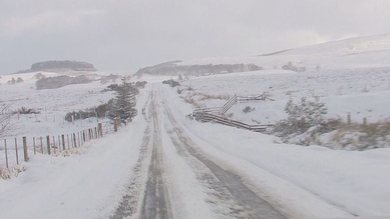
Yellow weather warnings for snow and ice have been put in for most of Scotland’s Central Belt, East Coast and the Highlands including Orkney and Shetland.
Winds of up to 50mph and up to 40cm of snow are forecast in some areas, with the worst expected to hit north-west Wales and northern England.
It comes as the Highlands recorded the coldest March temperature in the UK for more than a decade, according to Met Office forecasters.
Warnings have been issued that the Highlands could see minus 17C, after this year’s record low of minus 16C was recorded at Altnaharra in the region.
Amber warnings have been issued for northern England, the Midlands, North Wales and Northern Ireland where “significant disruption” to transport and power supplies is expected.
Traffic Scotland have issued warnings to those travelling until 10am on Friday and again over the weekend.
Met Office meteorologist Alex Burkill said that a pocket of western Scotland covering Glasgow and the county of Argyll may be the only region untouched by heavy rain and snow over the next 24 hours.
Of the worst hit areas, he added: “The combination of heavy snow and gales is why we’re likely to see blizzards and drifting snow which causes extra hazards on the roads.
“In places covered by amber warnings, there will be very difficult, treacherous conditions.
“Ideally, avoid travelling in those periods – but if you have to head out then be aware that journeys could take significantly longer.”
Met Office meteorologist Jonathan Vautrey said the storm, which has been named by the French weather service, is bringing rain and snow to the UK.
“Storm Larisa, which Meteo France have named, is the same low pressure system that is bringing us the bands of rain,” he said.
“But essentially, we’re on the northern side of the low pressure system and it’s the southern side of that low pressure system that is going to be bringing particularly strong winds to parts of France.
“So that did originate out in the Atlantic and then it tracked its way eastward towards us, and the weather fronts that are swirling around that low pressure system have then been pushing into the cold air that has been in places across the UK and allowing that rain to start falling as snow across several areas.”
The weather is expected to clear by the end of Friday, before then being replaced by another low pressure system, leading to a further yellow snow and ice warning for parts of Scotland and northern England from 3pm on Saturday to 6am on Sunday.
Follow STV News on WhatsApp
Scan the QR code on your mobile device for all the latest news from around the country