Latest updates
-
 Emergency alert sees phones emit ‘loud siren’ ahead of Storm Eowyn
 -
 All schools across central Scotland will be closed on Friday
 -
 ScotRail has suspended all services on Friday
 -
 CalMac cancels all services ahead of Storm Eowyn
 -
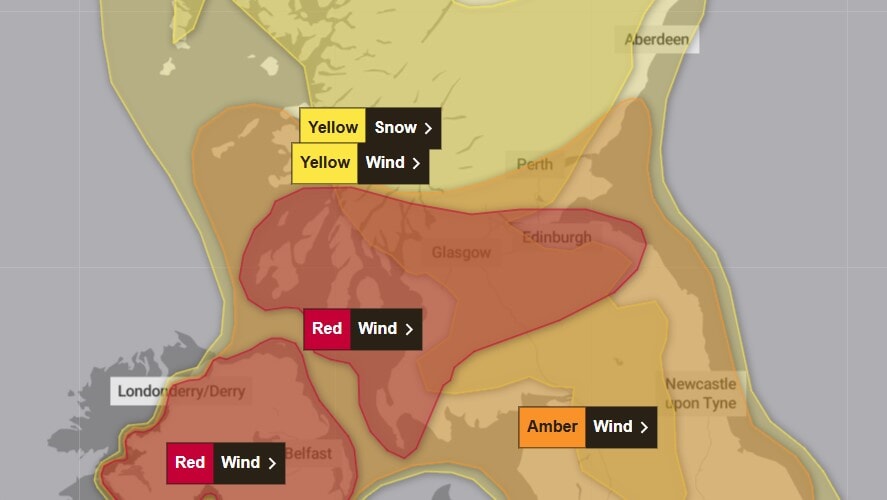
 A red warning has been issued for wind by the Met Office
 -
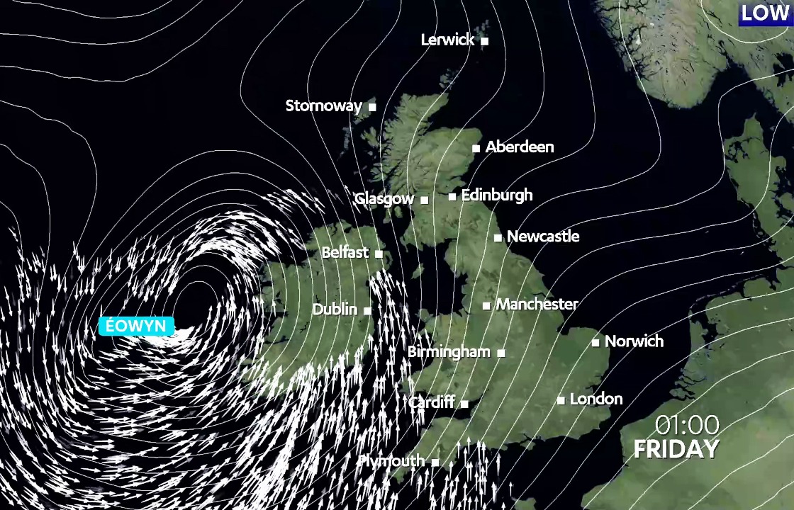
 Storm Eowyn is set to batter Scotland with hurricane force winds
 -
 Flying debris could cause injuries and danger to life
 -
 Police warn drivers to avoid unnecessary journeys and consider delaying travel plans
Scotland will be battered with life-threatening hurricane-force winds on Friday, sparking mass school closures, nationwide transport suspensions and warnings to stay indoors and avoid travel.
A rare Met Office red alert has been issued as Storm Eowyn brings the most intense weather in recent history with winds speeds of 100mph.
The first-ever use in Scotland of the UK-wide emergency alert system saw phones belonging to those in the affected areas emit a loud siren and display urgent guidance from the government.
All schools across central Scotland will be closed on Friday including in Glasgow, Edinburgh, and Renfrewshire. Councils confirmed all nurseries, primaries and secondaries will be shut.
ScotRail has suspended all train services while CalMac has cancelled all ferry sailings throughout Friday.
Many services were already disrupted or cancelled due to Storm Eowyn, but both the train and ferry operators have taken the decision to implement network-wide cancellations.
First Bus has cancelled all services across Greater Glasgow from 8am to allow vehicles and staff to return to the depot. Meanwhile, McGill’s services will also be cancelled between 9am and 6pm and Lothian Buses between 10am and 5pm.
Ferry sailings between Cairnryan and Northern Ireland have been cancelled, and those booked onto sailings are urged not to travel to the area.
@stvnews A rare red alert has been issued as Scotland braces for Storm Eowyn bringing the most intense weather in recent history with 100mph gusts. #stvnews #scotland #stvweather #stormeowyn ♬ original sound – STV News
The Met Office issued the most severe possible warning for Friday, forecasting “flying debris resulting in danger to life”.
People have been urged to stay indoors and not travel under what has been described as “exceptional circumstances” by STV meteorologist Sean Batty.
 Met Office
Insight Sean Batty STV meteorologist
Red warnings are very rare and are only issued in exceptional circumstances.
Red warnings come with advice to refrain from travel where possible, and those who can work from home should do so. The good thing is that a lot more people nowadays have the ability, and offices the infrastructure, to allow this to happen more post-Covid.
One of the most significant aspects of this storm is its timing, with the peak expected during daylight hours when more people are likely to be out and about. Storms like this can bring down trees onto roads and railway lines with little warning, and falling debris from buildings poses a serious hazard. For these reasons, staying at home during such periods is much safer.
The warning covers Stirling, Falkirk, Clackmannanshire, Aberdeenshire, Dumfries and Galloway, Fife, the Highlands, Tayside, Strathclyde, the Scottish Borders and parts of the Lothians.
Additional yellow warnings for snow and wind have also been issued, the first of which comes into force at midnight on Friday.
The storm will bring peak gusts of 60-70 mph fairly widely inland, 70-80 mph in some areas, and 80-90 mph along more exposed coasts and hills, the Met Office said.
Forecasters warned that flying debris, large waves, and beach debris thrown onto seafronts, coastal roads, and properties could cause injuries and danger to life.
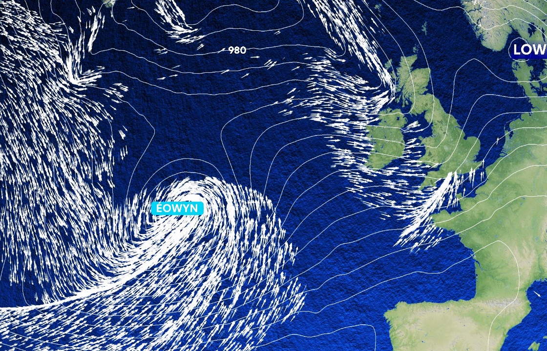
Storm Eowyn is the fifth named storm of the season after Storm Darragh brought strong winds and snow to parts of the UK in December.
 STV News
Transpennine Express urged customers not to travel to Scotland, York, Liverpool, Newcastle, and Manchester on Friday.
Road, rail, air, and ferry services may also be affected, with longer journey times and possible cancellations.
Police have urged motorists to avoid unnecessary journeys and to delay travel plans until conditions improve.
Drivers are urged to prepare vehicles for the conditions, ensuring mobile phones are fully charged and journeys are planned in advance, with alternative routes plotted out.
Police added that motorists should ensure they have sufficient fuel, warm clothing, food and water in case of delays on roads.
Meanwhile HGV and bus drivers have been urged to drive with extreme caution due to risks of high-sided vehicles being blown over. Cyclists, motorcyclists and pedestrians should also consider the risks of being blown over or into the path of other road users.
The RNLI has also urged people to stay safe, adding that those near the coast to be aware of the dangers the weather could bring.
Send us your Storm Eowyn videos
Have you been impacted by the weather? Send us a message by clicking below and describing what you have captured on camera
The charity said for those who plan to visit the coast during this time, the strong gusts pose a significant risk to safety and it is urging the public to exercise extreme caution, particularly along exposed cliffs, seafronts and piers.
RNLI Water Safety lead for Scotland, Michael Avril, said: “Storm Eowyn is set to bring potentially dangerous and uncertain conditions so we’re asking the public to stay vigilant.
“If you plan to visit the coast, the RNLI advises that you stay a safe distance from the water as conditions could knock you off your feet or wash you into the sea. It is not worth risking your life.
“If you find yourself in trouble unexpectedly in the water, remember to Float to Live; lie back in the water, extend your arms and legs and try to relax as best as you can until you get control of your breathing.
“If you see someone else in danger in the water, call 999 and ask for the Coastguard. If you have something that floats that they can hold on to, throw it to them. Don’t go in the water yourself – you could end up in difficulty too.”
Follow STV News on WhatsApp
Scan the QR code on your mobile device for all the latest news from around the country


 STV News