Latest updates
-
 Yellow weather warnings for wind remains in place as Storm Bram leaves the north of Scotland
 - The M74 was closed for 16 hours after multiple lorries were blown over in South Lanarkshire
- All CalMac ferries are facing disruption or cancellation
- Network Rail said a train struck a trampoline on the line south of Perth
- ScotRail said a majority of services are unaffected
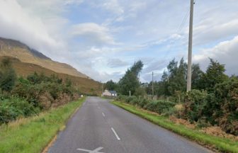
- But the Fort William to Mallaig line, Dingwall to Kyle of Lochalsh line and Cathcart to Neilston line are closed
Lorries have been blown over, all CalMac ferries are facing disruption or cancellation and train lines have been blocked after Storm Bram whipped Scotland with extremely strong winds.
Yellow weather warnings for wind remain in place for much of the north of Scotland.
The M74 was closed for 16 hours after multiple lorries were blown over in South Lanarkshire. The motorway near Abington reopened shortly before 9am, with police saying no injuries had been reported.
ScotRail has confirmed that a majority of services are unaffected, however, those on the Fort William to Mallaig line, Dingwall to Kyle of Lochalsh line and Cathcart to Neilston line are still closed to allow for inspections for damage.
Network Rail said: “Routes closed by #StormBram (Fort William – Mallaig and Dingwall – Kyle of Lochalsh) must be inspected at first light for damage or debris before reopening.
“We’ll use our engineers, locomotives and empty @ScotRail trains to do this, and we’ll keep you updated in the morning.”
According to the CalMac website all 30 routes remain impacted by the adverse weather conditions with some services being cancelled.
On Tuesday evening, Network Rail said a train struck a trampoline on the line south of Perth.
A statement read: “The train is back on the move, but if you live next to the railway, please help us by securing garden furniture, sheds and trampolines so we can keep services moving.”
Network Rail also said a fallen tree was causing overhead wire damage near Whitecraigs on the Glasgow Central to Neilston line.
ScotRail said on X: “Network Rail are responding to reports of a tree falling onto the overhead lines near Whitecraigs.
“Services on our Glasgow Central – Neilston line will be cancelled, delayed or revised until this tree has been removed, the damage inspected and repairs carried out.”
Additionally, the operator said two fallen trees on the line between Kilmarnock and Carlisle via Dumfries, one at Thornhill and one at Eastriggs, were causing disruption.
One of the trees is trapped underneath the train with engineers en route.
Glasgow Airport said a number of arriving and departing flights were experiencing delays or diversions.
A statement read: “We advise passengers, as well as those collecting friends and family, to check the status of their flight with airlines.”
Strong winds and heavy rain brought down power lines, leaving many homes and businesses without electricity.
Engineers have been deployed to assess the damage, but the duration of restoration efforts remains unknown due to hazardous conditions.
CalMac has said a number of ferry routes on the west coast are cancelled or are facing disruption.
Due to strong winds exceeding 50mph, the Forth Road Bridge was closed to double-deck buses, motorcycles, vehicles with trailers, cyclists and pedestrians.
The Tay Road Bridge remains closed to high-sided vehicles.
Follow STV News on WhatsApp
Scan the QR code on your mobile device for all the latest news from around the country