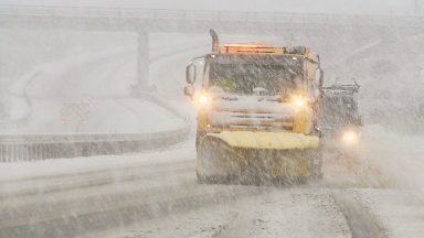
Travellers have been warned of more misery on the roads as plummeting temperatures could see major routes affected by snow.
It comes as the clean up operation following Storm Gerrit gets under way, after thousands of homes were left without power amid heavy winds and driving rain.
Motorists were caught up in treacherous driving conditions, with major roads such as the A9 and A90 impassable due to snow and flooding.
The Met Office has now issued fresh yellow weather warnings for rain and snow from 8am on Saturday morning, stretching to 3pm for southern parts of Scotland including Dumfries and Galloway, Ayrshire and the Scottish Borders.
Meanwhile other parts of the country including Angus, Fife, Perth and Kinross, the Highlands, Aberdeenshire, Moray, the Western Isles and Argyll and Bute will see the weather alert extended to shortly before midnight.
As temperatures are set to dip to as low as -10C on Friday evening, Saturday could see more misery on the roads for travellers with up to 10cm of snow falling on higher routes such as the A9, A85, A95 and A96.
It means many attempting to travel home following the festive period or heading to Hogmanay parties may be impacted by the latest weather warning.
Meanwhile areas which were hit badly by flooding in recent days could see more of the same, with heavy rain expected in Dumfries and Galloway, Angus, Aberdeenshire and northern parts of the Highlands on Saturday.

Insight Sean Batty STV meterologist
Here we go again – well not quite as bad as Storm Gerrit, but another day with plenty of rain, and snow on high ground.
After a cold night on Friday with temperatures as low as -10C in the Highlands, another weather front will be arriving from the west which will spread east across the country on Saturday bringing another bout of heavy rain – again in areas that have seen the worst rainfall in recent days.
The focus for the heaviest rain will be across Dumfries and Galloway, Angus, Aberdeenshire and the north Highlands where around 30-40mm of rain could fall. Again, this could lead to localised issues given the already saturated conditions with road and field flooding likely.
Given the cold conditions initially, snow will fall with a risk of a few centimetres to low levels before turning back to rain. At higher levels snow will last longer with as much as 10cm above 250 metres. This means that higher routes such as the A9, A85, A95 and A96 are at threat of another very snowy spell for a time on Saturday which could lead to further travel issues.
For those planning on Hogmanay travel on Sunday or on New Year’s Day, I have better news as the weather quietens down a bit, although there will still be some rain in the far north and west of the country.
For most it should be largely dry for the bells, including Edinburgh – great news for revellers heading to the big party in the capital to bring in 2024.
Longer term, our focus for January is likely to be colder conditions with more widespread snowfall, especially as the month progresses. So we may well wave goodbye to the stormier conditions of 2023, but it’s looking increasingly likely that colder air will usher in 2024.
Follow STV News on WhatsApp
Scan the QR code on your mobile device for all the latest news from around the country


