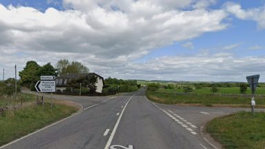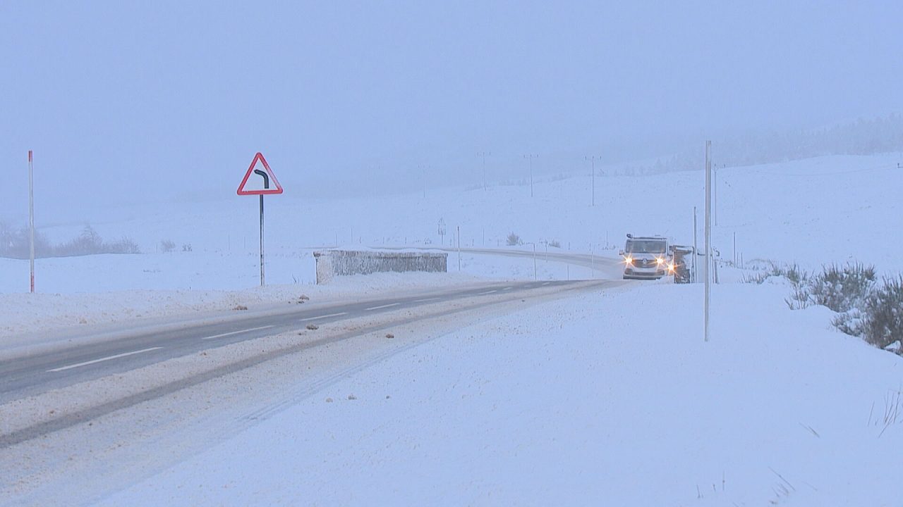
Heavy snowfall is forecast to bring disruption to large parts of Scotland as a raft of weather warnings spans the country this weekend.
A fresh amber alert for snow has been issued for central and north-eastern Scotland, covering an area from Tyndrum to Grantown-on-Spey and east to Banchory. The warning is valid from around 3am until 2pm on Sunday.
The Met Office warns that 20–30cm of snow could fall in places, particularly above 300 metres, with power cuts likely and a good chance of rural communities becoming cut off. Travel is discouraged unless necessary, with hazardous conditions expected on roads and untreated pavements.
Alongside the amber alert, a further yellow snow and ice warning will in place for most of Scotland from 2am until 3pm on Sunday. Even at lower levels, 5–15cm of snow is possible in eastern areas and up to 10–20cm on higher ground before snow turns to rain later in the day.
Meanwhile, two separate yellow rain warnings are coming into force. In the North West, covering much of the Highlands from Caithness and Skye south to Oban and Inveraray, the warning runs from 2am on Sunday until 10am on Monday.
Widespread rainfall of 40–60mm is expected, with up to 110mm possible in parts of Skye, Argyll and the Trossachs.
The second alert comes into play across the South West, affecting parts of Dumfries and Galloway. This warning also begins at 2am Sunday and ends at midnight.
Around 30–50mm of rain is expected, with up to 90mm on higher ground, and snow melt could further increase the flood risk.
A yellow wind warning covering the whole of Scotland comes into effect from midnight tonight until 9pm on Sunday. Gusts of 45–60mph are expected widely, particularly in exposed coastal areas and higher ground, with gusts up to 70mph possible across the Western Isles, Orkney and Shetland.
A further wind alert follows from 9pm Sunday until noon on Monday, stretching from Inverclyde to John O’Groats and covering the west coast and Inner and Outer Hebrides.
The Met Office warns of a danger to life from flying debris, with a small risk of gusts reaching 80mph in exposed locations.
The forecast conditions are expected to impact both road and rail networks, with the potential for challenging driving conditions and route closures, as well as delays and service cancellations.
Transport Scotland has activated its Multi-Agency Response Team to monitor conditions and support frontline and resilience partners. SEPA has warned that rising temperatures and snow melt, combined with heavy rain, could lead to flooding of low-lying land, roads and individual properties.
Pascal Lardet, SEPA Flood Duty Manager, said: “With rainfall forecast to move into south west Scotland on Sunday and then spread north and as temperatures rise following recent cold conditions, rain and thaw of lying snow from Sunday onwards will increase the risk of flooding. Possible impacts could include flooding of low lying land, roads and individual properties. Keep up to date on the latest information by checking our three-day Scottish Flood Forecast .”
Cabinet Secretary for Transport Fiona Hyslop said: “This prolonged period of disruptive winter weather is set to continue, with the Met Office forecasting further heavy snowfall in the north of Scotland.
“The conditions will inevitably impact the transport network, so it is vital that people and communities continue to plan ahead to ensure they stay safe. If you are in the area covered by the amber warning, you should consider delaying journeys if you can and working from home if that is an option.
“If you need to travel, then please drive to the conditions and follow Police Scotland advice. You can find the most up to date information on the trunk road network on the Traffic Scotland website and social media channels, and this will let you know if your planned route is available. If you are planning to travel by rail, air, or ferry, please check with your operator before you set off to see if your service has been impacted by the weather conditions.
“The past ten days have brought some real challenges for frontline staff, so I would once again like to thank them all for their tireless work to keep Scotland moving and ensure key routes remain open.”
Assistant Chief Constable Alan Waddell said: “Local resilience partnerships are continuing to meet to co-ordinate and deliver the response to disruption experienced by communities in the north and north east of Scotland following heavy snowfall over the last few days.
“We have been working closely with resilience partners across local authorities, other emergency service partners, transport partners, NHS and health and social care partnerships, and other local organisations to support communities affected by adverse weather and keep public services open where possible. Some services may be impacted by adverse weather, and I would encourage the public to check on neighbours or relatives, if they are able to do so safely.
“Significant gritting and road / footpath clearing operations continue to improve connectivity in communities, however this will take time to complete and may be impacted by further forecast snowfall. Care for People groups continue to contact individuals identified as vulnerable and are supporting them.
“Impacts from the heavy snowfall and ice, in addition to potential for some flooding as temperatures rise, means that driving conditions may be hazardous in some areas. Our advice is to plan ahead and consider if your journey is really necessary.
“If you need to travel, please fully clear your vehicle windows of snow and ice before you drive, drive to the conditions, be prepared for delays and allow extra time for your journey.
“Wet conditions can also cause spray which reduces driver visibility. Drivers should be aware of increased stopping distances, which will be at least double those required for stopping on dry roads.
“Driving through areas of flooding can result in catastrophic damage to your vehicle. It may also result in the road becoming blocked with recovery required and may delay emergency services and road maintenance workers.”
Mark Ilderton, ScotRail Service Delivery Director, said: “As a result of forecast severe weather in some parts of Scotland, it’s likely that there will be disruption to ScotRail services on some routes.
“We may also see speed restrictions implemented across parts of the network meaning that some journeys may take longer than usual.
“We would urge passengers to check their full journey before they travel using the ScotRail website, app, or our social media channels.
“Our teams across Scotland will be working flat out to keep people moving where possible in difficult weather conditions.
“We’re grateful to our customers for their understanding as this period of severe weather continues.”
Follow STV News on WhatsApp
Scan the QR code on your mobile device for all the latest news from around the country