Latest updates
-
 An amber warning for rain has been issued for Hogmanay
 -
 A yellow weather warning for snow and rain is currently in place
 -
 Second warning for snow has been issued for parts of Scotland
 -
 Severe flood warnings issued around Aviemore which could bring a ‘danger to life’
 -
 ScotRail has confirmed line at Kingussie has been closed due to flooding
 -
 Edinburgh Street Party among Hogmanay celebrations cancelled due to weather
An amber weather warning has been issued for parts of Scotland as heavy rain and snow persist, dampening Hogmanay celebrations.
On Saturday, the Met Office predicted that most of the country could face disruption due to a deluge of rainfall and snowfall in some areas from Monday until Hogmanay.
The first yellow warning for snow and rain came into place at midnight on Monday and will expire at 11.59pm on Tuesday.
Forecasters said heavy rain will become “persistent and widespread” on Monday and Tuesday, bringing rainfall totals between 50 and 70mm in some areas.
The Met Office said that fast-flowing and deep floodwater from the rain may bring a “danger to life”.
Higher ground in parts of western Scotland may see 100 to 140mm of rainfall.
The Scottish Government Resilience Room (SGORR) has also activated in response to the weather warnings.
The First Minister will chair a meeting of SGORR on Monday evening to review plans for the challenging weather ahead.
Scottish Government said officials will continue to monitor the situation and work with frontline agencies to mitigate the impacts of the severe weather.
A second yellow warning for snow has been issued for Orkney and Shetland, which will come into force at 5am on Hogmanay and persist until shortly before the bells.
The Met Office has also issued an amber warning for rain, covering Moray and the Highlands, which comes into force on Tuesday at midnight and will expire at 5pm.
The Scottish Environment Protection Agency (SEPA) said Scotland will see “significant flooding impacts” in the coming days as more persistent and heavy rain arrives.
Severe flood warnings were issued on Monday for Sluggan to Dulnain Bridge, Kincraig to Inverdruie, and Aviemore/Dalfabar to Grantown.
Cordelia Menmuir, flood duty manager for the Scottish Environment Protection Agency (SEPA) said: “We have issued three severe flood warnings for the Aviemore and Carrbridge areas.
“As a result of heavy and prolonged rainfall overnight very high river levels are forecast for the early hours of Tuesday morning along the River Spey. There is a danger to life.
“Extensive river flooding is forecast and there will be widespread disruption to transport, infrastructure, and property flooding. Remember to follow the advice of emergency responder and do not walk or drive through flood water.”
Police Scotland Superintendent Jennifer Valentine said: “Following significant and continuing rainfall across the Highlands and Moray, we are dealing with challenging weather conditions, as well as rising river levels, and are asking people to take care.
“We are working hard with a range of multi-agency partners to support communities and those who need our help.
“Roads across the area are affected by surface water, and overnight we expect a number of roads, particularly around the Aviemore area, will become flooded.
“Our advice is to avoid these areas due to hazardous conditions. Please consider if your journey is really necessary or if it can be delayed until conditions improve.”
Edinburgh’s Street Party, as part of a number of outdoor Hogmanay celebrations, has been cancelled due to the extreme weather.
Meanwhile ScotRail confirmed that the line in the Kingussie area has been closed due to flooding.
The rail operator warned that services between Inverness and Edinburgh as well as Glasgow Queen Street will be cancelled, delayed, or revised.
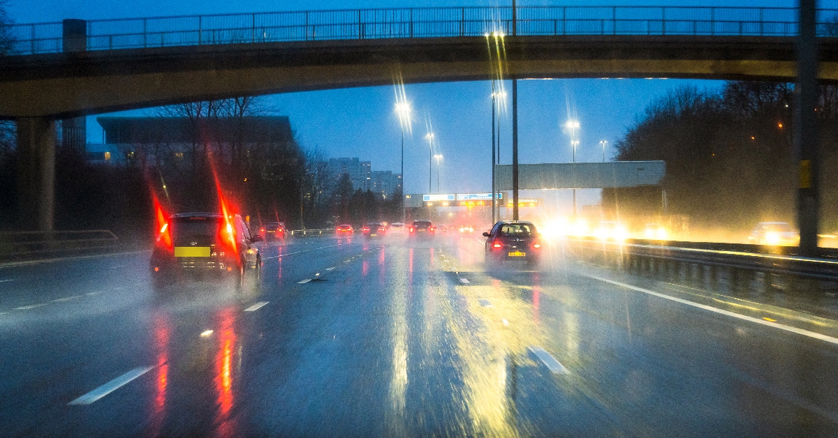
Drivers have been warned to expect “difficult” driving conditions and some road closures due to the weather.
The Met Office said those using public transport should also plan for longer journey times.
It added that snowfall is likely in and around Perthshire, with 10-20cm accumulating on higher ground.
Forecasters warned that as milder air pushes in, snow will turn back to rain, and any rapid snow melt will contribute to flooding in places.
“Strong winds may exacerbate impacts, particularly across the areas of Scotland affected by snow,” it added.
Forecasters added that “blizzard conditions” are possible, especially over high ground and across much of Sutherland and Caithness, warning that powerline icing is possible where blizzard conditions occur.
On Monday, the Erskine Bridge was closed in both directions due to high winds.
The First Minister has urged Scots to take advice from the SEPA and the Met Office following weather warnings for Monday to Thursday.
SEPA has urged people in the north west and central Highlands to “be prepared, be aware” as flooding is expected in the run-up to Hogmanay.
On X, Swinney said: “There are weather warnings issued for Monday and for Hogmanay. Please follow all of the advice available and stay safe.”
The warnings come as Edinburgh’s torchlight procession was cancelled due to high winds.
The event in the capital marks the beginning of the Hogmanay celebrations, with the parade due to begin at 7.30pm from the Meadows on Sunday.
Thousands of people were expected to make their way through the city’s streets.
However, Edinburgh’s Hogmanay confirmed that the traditional parade was unable to go ahead due to high winds at some sections of the route.
Follow STV News on WhatsApp
Scan the QR code on your mobile device for all the latest news from around the country


