The second named storm of the season will batter Scotland with extreme rain and wind this week.
Storm Babet will bring the potential for exceptionally wet conditions across parts of the country presenting threat to life.
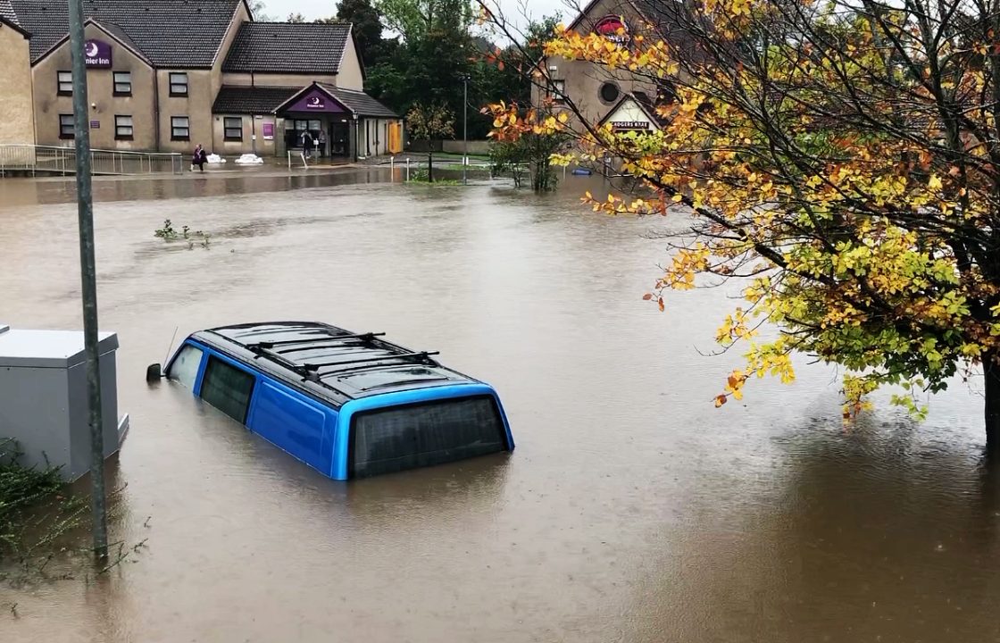
It comes after much of Scotland suffered widespread flooding earlier this month.
The country will see a return of heavy downpours with multiple severe weather warnings in place for Wednesday, Thursday, Friday and Saturday.
People have been urged to prepare if they are in an affected area.
#StormBabet has been named by @metoffice and is forecast to bring impactful heavy rain to the UK from Wednesday this week
— Met Office (@metoffice) October 16, 2023
Strong winds will accompany the storm
Stay #WeatherAware pic.twitter.com/YJYB3haD4L
There is concern that surface water flooding may be exacerbated by debris blocking drainage and culverts as a result of the high winds.
Gusts in excess of 60mph are possible in eastern and northern Scotland from Thursday.
The alert covers much of central and southern Scotland on Wednesday before extending to almost all of the country on Thursday.
Coming into force at 6am on Wednesday, a yellow warning for heavy rain is in force until 6am on Saturday.
A warning for wind is in force from Thursday until midday on Friday.
Earlier this month, parts of Scotland saw up to three weeks worth of rain fall over a short period of time, leading to businesses and homes being flooded and areas cut off due to landslips.
It comes after the body of a man swept away in the River Tay was discovered.
Power and phone lines could be impacted while motorists have been urged to take care due to dangerous driving conditions.
Public transport may be subject to delays and cancellations amid the heavy rainfall.

Insight Philip Petrie STV weather presenter
“As of Monday morning Storm Babet has been named – a system that will affect parts of Scotland from Wednesday to Friday, and multiple warnings have already been issued,” said STV weather presenter Philip Petrie.
“On Sunday the Met Office issued a yellow weather warning for rain, starting Thursday and lasting until Saturday – and for the Met Office to issue a warning that far in advance, it normally means something significant is on the way.
“This is our second named storm of the season, and it will approach us from the south west late Tuesday, moving through across the second half of the week.
“The cause of concern is that at times the rain will linger for prolonged spells because the frontal systems that bring the rain stall across Scotland. High pressure across Scandinavia will block the rain from going anywhere which will lead to some high totals of rain, affecting areas where the ground is already saturated. We could see up to a month’s worth of rain in two to three days across parts of Angus, south east Grampian and Stirling.
“Along with this we see strong south easterly winds bringing gales along eastern coasts and on the tops of the hills.
“This will be a developing story, so we will be keeping an eye on things over the next couple of days, with further warnings likely to be issued by the Met Office.”
Follow STV News on WhatsApp
Scan the QR code on your mobile device for all the latest news from around the country