 NOAA
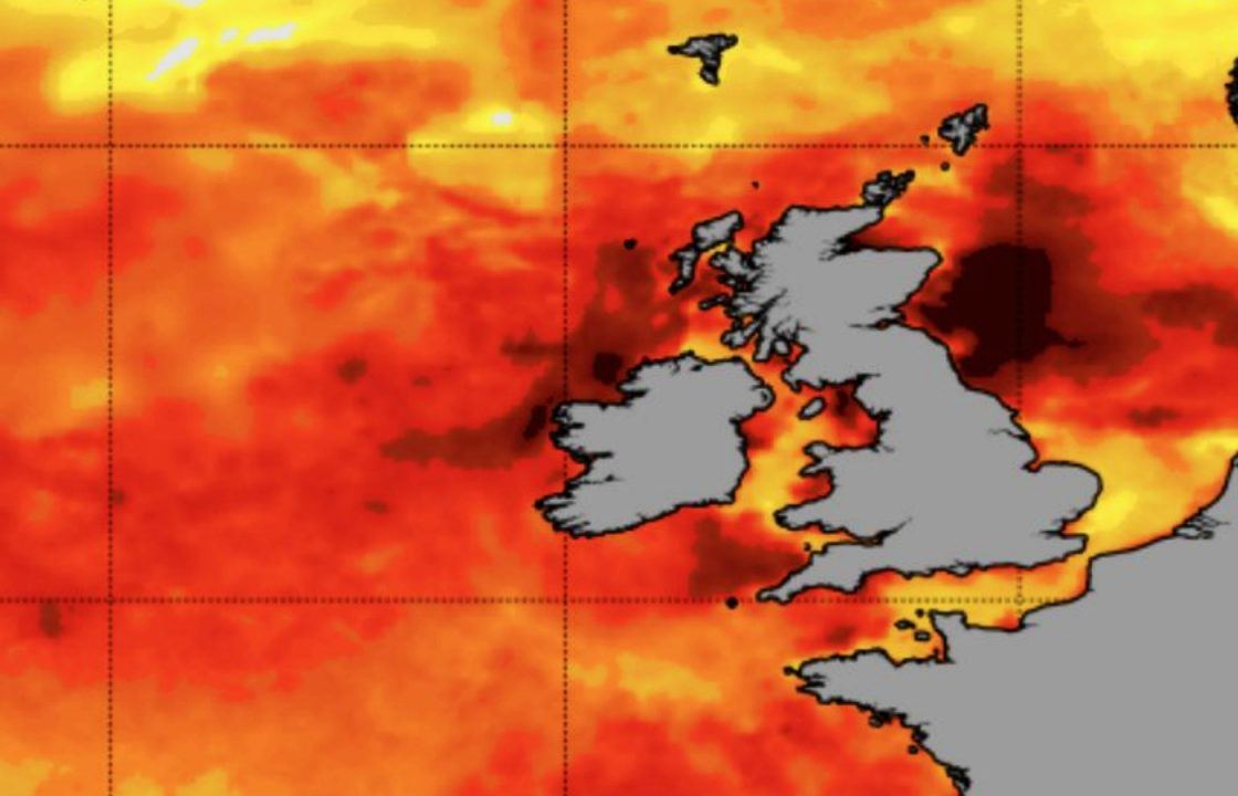
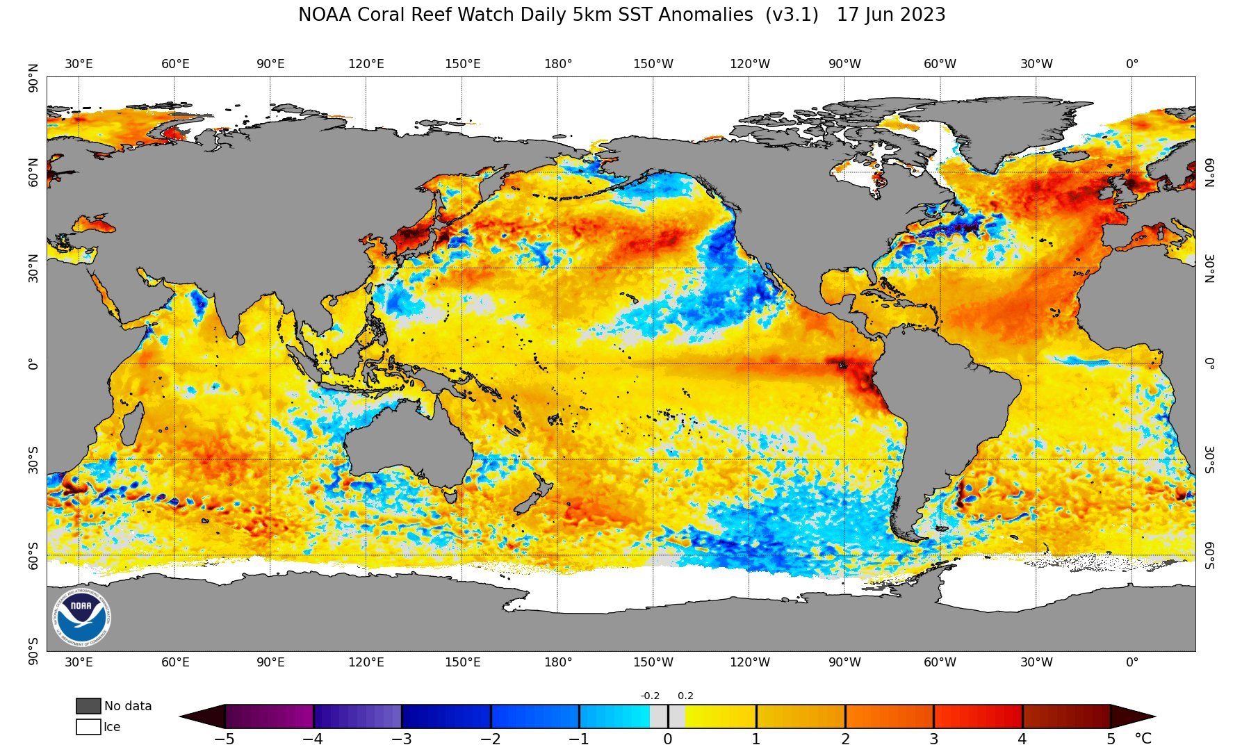
NOAAAn “extreme” marine heatwave has been declared in the North Sea, with areas off Scotland reaching temperatures 4C higher than normal.
The European Space Agency said ocean surface temperatures were at an all-time high and warned of more record-breaking weather events soon.
The US National Oceanic and Atmospheric Administration (NOAA) declared a “very rare” category four marine heatwave – classed as extreme.
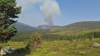
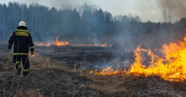
The heat could have a serious impact wildlife and fishing but could also affect the weather on land.
 NOAA
NOAAIt comes as Earth experienced its third-warmest May in 174 years.
STV meteorologist Sean Batty predicts further episodes of extreme heat this summer, with even more to come next year.

Insight Sean Batty STV meteorologist
Media has been abuzz about the recent heatwave conditions and the potential onset of drought conditions, but there’s an even more significant development unfolding.
Over the past few months, the North Atlantic has been experiencing an unprecedented surge in warming, reaching record-breaking temperatures that are, on average, about a degree higher than normal.
This seemingly minor increase conceals the alarming fact that certain regions are experiencing a staggering three to four degrees above normal temperatures – which is just crazy.
A few theories have been touted to explain this phenomenon.
One could be that the typical ocean currents responsible for temperature equilibrium, where cold and warm waters are exchanged, have slowed down, resulting in the accumulation of warm water in certain areas.
Another possibility is the very low levels of Saharan dust in the air above the Atlantic.
At first glance, this might sound odd, as you may wonder what impact dust has on our ocean temperatures.
During the summer, the amount of Saharan dust over the Atlantic typically increases, creating a haze that dims sunlight and reduces the amount of solar radiation reaching the ocean’s surface. Consequently, this lessens the heating effect.
But what does this mean for us? Well, it could potentially lead to further episodes of extreme heat this summer.
The warmer-than-normal waters surrounding us fail to provide the same cooling effect on the inflow of warm air into the UK. Additionally, the increased moisture in the air due to warmer waters may result in more thunderstorms and a heightened risk of flooding throughout the summer and autumn.
If the Saharan dust doesn’t make a prompt return to cool the north Atlantic, we could face more severe storms in the autumn and winter.
Occasionally, the remnants of hurricanes in the Atlantic make their way to our shores, but without the usual cooler waters to temper them, they may arrive in a more vigorous state than usual.
Winter could bring reduced snowfall, as cold air masses traversing warmer waters will arrive with higher temperatures than expected — bad news for our ski resorts.
However, any intense blasts of frigid air could still result in substantial snowfall in some areas.
So, you can see how this extreme warming in the Atlantic may bring further extreme and long-lasting impacts to our country.
There’s also a build-up of warmer waters in the mid Pacific, this however is a natural cycle which occurs every several years known as El Nino. It’s counterpart La Nina does the opposite and cools the equatorial Pacific.
The reason I’m bringing this up is that we’re entering an El Nino phase which is when we usually hit new global temperature records, but if this is combined with higher ocean temperatures elsewhere around the globe this could make 2024 and 2025 exceptional years for global heat.
We find ourselves entering uncharted waters, as this record-breaking Atlantic heat is an unprecedented event in our recorded history.
When coupled with the impending El Nino, the situation becomes even more complex.
Nevertheless, by enhancing our understanding, knowledge, and providing advanced warnings about these extreme conditions, we can better prepare ourselves.
For those of you who, like me, experience climate anxiety, I try not to exacerbate it.
Although we may experience more extreme events in the coming months, our increased awareness can help in our readiness and resilience.
Follow STV News on WhatsApp
Scan the QR code on your mobile device for all the latest news from around the country