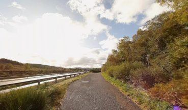
We’ve waited all summer for days like this – not a cloud in the sky and blue skies forever – although the sun does now sets around 8pm on the west coast.
The Inner Hebrides and Kintyre have truly shone today with Mull, Jura, and Islay basking in highs around 25C – what a day for the islands. However, not everyone in the country enjoyed such luck. Cloud cover persisted in parts of Easter Ross, Inverness, and Moray, and it took a while for the skies to clear over Renfrewshire, Glasgow, North Lanarkshire, and Falkirk earlier today. The southern Fife coast, along with Edinburgh and East Lothian, also held onto a stubborn layer of cloud.
The good news? We’re in for another sunny day tomorrow – and it’s a Saturday! Once again, Argyll and Bute, the Highlands, and Ayrshire will see the best of it, with temperatures peaking in the mid-20s. Some areas like Johnstone, Paisley, Glasgow, Airdrie, Bathgate, Falkirk, and Cumbernauld will start cloudy, but like today, the sun should break through later. Meanwhile, the north and east coasts might continue to see lingering cloud, poor visibility, and haar.
Sunday, however, brings a shift. Expect a much cloudier day, with drizzle, mist, and fog, particularly in the east. The west will see some sunshine, though not as much as in previous days, but it will still be warm.
Next week brings a dramatic change. By Wednesday, we’ll feel the arrival of autumn as a northerly flow ushers in much cooler air and showers. And yes, believe it or not, snow is expected in the mountains! It’s not every day I get to mention 25C and snow in the same forecast.
It’s all pretty normal stuff to have wild rollercoaster swings between warmer and colder spells in autumn – although this is perhaps a little earlier than I’d normally expect, but then again, it felt like summer was a bit of a non starter. My advice: keep both your fan and winter duvet close at hand!
Follow STV News on WhatsApp
Scan the QR code on your mobile device for all the latest news from around the country


