 iStock
Scotland is about to be plunged into a lengthy cold spell and I reckon some spots could be looking at their coldest November/early December nights for several years.
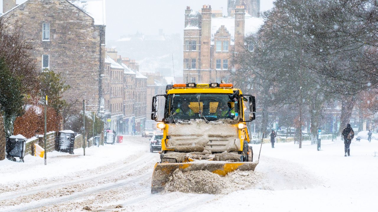
Yellow weather warnings have been issued by the Met Office covering northern and eastern parts of Scotland.
The alerts come into force from 5pm on Tuesday, with heavy snow and disruption expected until 11am on Thursday.
The timing and setup is very similar to 2010 when cold air flooded out of Scandinavia and temperatures dropped to lows of -16C in Altnaharra and -14C in Braemar.

At this stage it looks unlikely that we’ll see anything as low as that in the next week, but further south temperatures could get fairly close to the record November lows of -7C in Renfrewshire and -8C in Ayrshire, both recorded in 2010.
Like 2010, our cold air is originating from Scandinavia where temperatures have been unusually low for November, with parts of southern Norway currently around 10C below the norm.

In Finland on Monday, the temperature dropped to -34C at Savukoski Tulppio, making it the country’s coldest November day since 2002.
The cold weather currently being seen across northern Europe is some of the harshest for many years and it is unusual to be so cold at this point in the year.
Normally the coldest conditions would be seen in January and February as the Arctic continues to chill through the winter months.
This cold north to north easterly air flow across the UK in the coming week is likely to bring wintry showers to areas exposed to that flow, such as the Northern Isles, Aberdeen, Aberdeenshire, Angus, Fife, Edinburgh and Lothians as well as the Borders. However, unlike 2010, there’s currently no signs of any prolonged spells of snow.
Sleet and snow showers will fall in the north and east from Wednesday and continue on and off into the weekend.
The biggest accumulations will be on eastern facing slopes of the Grampians, the Sidlaws, Ochils and Lammermuirs. Anything at lower levels will be patchier and shouldn’t amount to too much with the main risk here being ice.
There’s good agreement from our computer models for this cold spell to last until at least the end of the first week of December, but beyond that we have a big divergence in scenarios.
To give you an idea we have one showing afternoon highs on December 11 of 13C in Glasgow and another showing -3C.
While forecasting beyond the first week of December is pretty impossible we at least know the start of advent will be festive. It’s worth keeping an eye on vulnerable family members, friends and neighbours during this spell to make sure they’re able to stay warm.
Follow STV News on WhatsApp
Scan the QR code on your mobile device for all the latest news from around the country