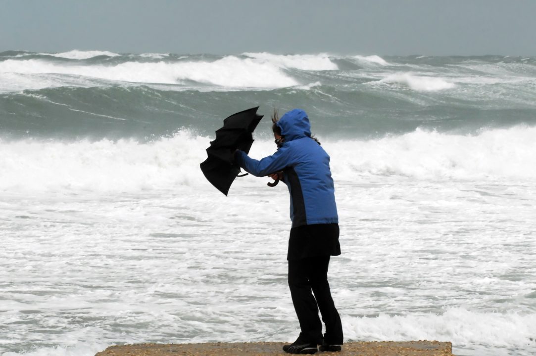
Scotland could be hit by gusts of up to 80mph after the Met Office issued two yellow weather warnings for parts of the country this week.
The first warning issued by the Met Office will be in place from 7am until 3pm on Friday, covering the Highlands and Argyll and Bute.
Wind gusts in excess of 60mph could hit more exposed parts of the affected areas, with 44-55mph winds expected fairly widely during the warning.
The second warning issued by the Met Office covers the whole of Scotland, which will come into place on Sunday at 3pm and last until 12pm on Monday.
Gusts of 50-60mph are possible for inland areas on Sunday morning that may reach up to 60-70mph along exposed coasts and hills.
During Sunday afternoon and evening, winds could reach 70-80mph in exposed areas of western Scotland and 55-65 mph in other parts of the warning area.
Met Office said the strong winds in conjunction with high spring tides may cause some disruption.
The forecasters said there is a “small chance” of injuries and danger to life from flying debris as the conditions pass through the country.
STV meteorologist Sean Batty warned people traveling via ferry on Sunday and Monday to expect disruption.
It comes amid the development of a low-pressure system in the Atlantic that looks set to intensify into a storm.
Sean said it is “highly likely” that the gusts will develop into the first storm of the season which will be called Storm Ashley.

Insight Sean Batty STV meteorologist
Over the past few days, computer models have been consistently predicting the development of a low-pressure system in the Atlantic, which looks set to intensify into a storm likely to impact Scotland this weekend.
It’s looking highly likely this is going to be named, and I expect warnings will be issued as we get closer to the weekend once there’s a bit more detail on track and intensity of the system.
The UK storm season officially resets in early September, so if the storm is named, it will be Ashley – the first of the season. The last named storm to affect the UK was Lilian in August, which brought heavy rain to the Borders and wind gusts reaching 60 mph on the mountain tops.
This will be the first spell of proper autumn gales for the country with most of the country experiencing a period of strong winds through Sunday and into Monday. Models are currently indicating that wind gusts could reach 70-75 mph in the most exposed parts of the Hebrides and Northern Isles.
This upcoming storm will mark the first significant autumn gales of the year, with much of the UK set to experience strong winds through Sunday and into Monday. Current models suggest gusts could reach 70-75 mph in the most exposed areas of the Hebrides and Northern Isles. Elsewhere, gusts of 50-60 mph are expected, and if the storm track holds, we could see a spell of particularly strong gusts sweeping across the central belt on Sunday night.
Adding to the potential hazards, we’re currently in a period of spring tides, when high tides are higher than usual. Combined with the strong winds, this increases the risk of coastal flooding and large waves along the coast.
As I say, the details of this system are still being watched, but expect to see some warnings in the coming days, and expect disruption if you’re planning a ferry trip on Sunday or Monday.
Follow STV News on WhatsApp
Scan the QR code on your mobile device for all the latest news from around the country