 PA Media
Key Points
Latest Scottish weather
-
 Met Office extends yellow weather warning for rain
 - ScotRail cancels all direct services between central belt and Aberdeen and Inverness
- Flooding likely to hit Aberdeenshire, Dundee, Angus, and Tayside
A yellow weather warning for heavy rain issued for parts of Scotland is in force as downpours are expected over the weekend.
Heavy rainfall is forecast for Aberdeen, Aberdeenshire, Angus, Dundee, and Perth and Kinross – most of which saw prolonged rainfall cause problems for residents last week, including flooding.
On both Sunday and Monday, Clackmannanshire, East Lothian, Edinburgh, Falkirk, Fife, Midlothian, Scottish Borders, Stirling and West Lothian will also be affected.
The Met Office yellow warnings will be in place until 12pm on Saturday, between 6am and 11.59pm on Sunday, and 6am and 11.59pm on Monday.
ScotRail announced there will be no direct trains running between the central belt and Aberdeen and Inverness until at least Sunday.
The travel operator warned that with speed restrictions in place services could be delayed or cancelled this weekend.
Shuttle services will run between Inverness and Perth as well as Aberdeen and Dundee.
ScotRail said: “Customers travelling between Edinburgh or Glasgow & Aberdeen/Inverness will need to change at Perth, for travel to Inverness, or Dundee for travel to Aberdeen.”
LNER said there will be extremely limited train services between Edinburgh and Aberdeen from Friday to Monday.
Those travelling are urged to check with their transport provider ahead of time.
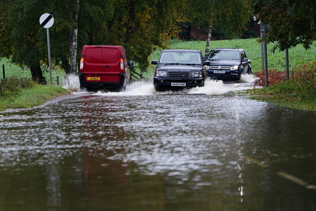
Roads are also affected, the A92 has been shut between Melville Lodges and Parbroath Crossroads, Parbroath due to flooding.
The latest Scottish Flood Forecast said “significant flooding impacts” are likely in the north east on Friday and Saturday due to more torrential downpours.
The latest Scottish Flood Forecast update, issued by the Scottish Environment Protection Agency, said significant flooding impacts from rivers and surface water are likely in the north east on Friday and Saturday.
There is also a risk of further impacts in areas recovering from recent flooding.
It said: “River levels are not expected to be as high as experienced during Storm Babet but as the rain will be falling onto already wet ground, flooding from surface water runoff may also cause impacts.
“Caithness and Sutherland, Easter Ross and Great Glen and the south west of Scotland may also experience some localised flooding due to persistent and heavy rain.”
Network Rail Scotland warned: “More extremely heavy rain is on the way. It won’t be to the levels from Storm Babet, but it will affect the same areas, already with saturated ground. It will bring a risk of flooding.”

Insight Sean Batty STV meteorologist
“A week on from Storm Babet and warnings of more rain just keep on coming, although some respite looks like coming next week, but before we get to that more rain will fall in the coming days.
“The focus for rain over the weekend will once again be in the east of the country, particularly around Fife, Angus, Perthshire and Aberdeenshire.
“The wettest conditions will be around Dundee, Angus and Perthshire on Saturday morning, although this should turn more showery in the afternoon as the main area of rainfall moves towards the eastern end of the Cairngorms. Heavier more persistent rain will return to the east on Sunday morning and last through much of the day, and will again focus on the Tayside region.
“For context Murton to the east of Forfar got about 100mm of rain on Thursday 19 October from Storm Babet, but the total for this weekend will likely be around 20mm.
“Even though this is nothing compared to the deluge last week, given the high water tables in this area further flooding is possible. I’d say it’s more likely to be fields, parks and any usual spots on the roads where we’ll see issues in the coming days.
“Up to 50mm of rain could fall over the eastern end of the Grampians in the next few days which will filter into the Dee, Don, North Esk and Isla, and while the river levels will not be as high as last week, this extra rainfall will continue to slow the drop in levels.
“In addition to the rainfall, minor issues could be experienced in coastal areas of the east and the Northern Isles with strong easterly winds during Saturday and Sunday which will lead to large waves during high tides which could overtop sea walls to affect coastal roads and streets.
“There’s signs of high pressure building next week from the north which should push storm tracks and the main rainfall band further south across England and Wales with drier conditions developing here.
“This however could be short-lived with some computer models showing a return to stormier conditions later in the week.”
Follow STV News on WhatsApp
Scan the QR code on your mobile device for all the latest news from around the country