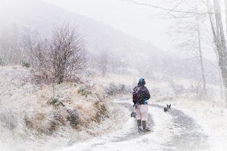
Forecasters have warned of potential travel disruption as wintry weather is set to sweep across some parts of Scotland.
The Met Office has issued yellow weather warnings of snow and ice for much of the north of the country, which run from 12am on Sunday until 11.59pm on Monday.
The warning spans Stonehaven and Aberdeen in the east to Skye and the Western Isles.
All parts of Scotland north of these areas are likely to be affected, with temperatures as low as minus 4C expected.
The Met Office warned travel disruption is possible with some roads and railways affected, and longer journey times by road, bus and train are likely.
It also warned of icy patches on roads, pavements and cycle paths, and said there is a small chance that power cuts will occur.
Mobile phone services may also be affected, and snow-covered roads may lead to stranded vehicles.
The Met Office has also issued a yellow weather warning of snow and ice for Northern Ireland early next week.
The warning comes into force on Monday at 3am and runs until 11.59pm on Monday.

Insight Sean Batty STV meteorologist
I’ve been describing next week as the cold core of winter, as I expect it’ll be when most areas experience their lowest temperatures of this winter. It comes at a perfect time for the coldest conditions to develop as the Arctic has had several weeks in darkness which means the air is now well chilled.
The northerly starts to develop on Saturday with showers turning wintry across Shetland, but it’ll be Sunday before most notice the distinct change with chillier conditions and more extensive snowfall in the north.
Throughout next week it’s the Northern Isles, north and west Highlands, Moray, Hebrides and north Aberdeenshire where we’ll see the main feed of frequent snow showers. However it’s not as clear cut as it normally is in a northerly flow because the air is so very cold. The very cold Arctic air crossing the relatively warmer seas to our north can sometimes create little features which go on to create longer spells of snow which can cross the country very quickly. They’re also tricky to forecast and getting the track right can also be problematic.
So while further south for the likes of Perth, Stirling, Glasgow, Lanark and Edinburgh a northerly brings sunny crisp days and very cold nights, one of these little features could develop a longer spell of snow on Tuesday and will need monitored. A few models are now starting to show a band of sleet and snow crossing into the southern Highlands on Tuesday morning and then moving south towards Fife and Edinburgh in the afternoon. So while it’s not a dead cert, if it does come off it could be disruptive for central Scotland and lead to some extremely cold nights afterwards.
The lowest temperatures will focus on areas with snow cover and decent clear skies overnight, so I think places like Aviemore, Grantown, Loch Glascarnoch, Tomintoul, Loch Cluanie and Laggan could reach lows of -12C to -15C from midweek. Further south all will depend on snow cover, but if Tuesday’s snow comes to fruition, lows could be around -8C to -10C in parts of Lanarkshire, Ayrshire, Borders, Renfrewshire and Stirlingshire. In the city centres of Glasgow and Edinburgh lows will probably reach -5C.
This upcoming spell of severe weather looks as though it’ll take its foot off the pedal by next weekend with overnight lows becoming less extreme and with an expected return to milder weather the following week. Of course if the milder air arrives with plentiful rain, added to snowmelt and frozen ground, this could lead to some flooding issues – although that’s a long way off.
Follow STV News on WhatsApp
Scan the QR code on your mobile device for all the latest news from around the country


