Major disruption on public transport is expected as Storm Dudley sweeps across Scotland.
An amber weather warning has been issued by the Met Office, with strong winds potentially reaching up to 90mph.
The warning will be active from 2pm on Wednesday, having been brought forward by two hours.
It is set to impact on central and southern Scotland.
ScotRail has announced that most of its services will be stopping earlier than normal, with most last services departing between 2pm and 3:30pm.
The amber warning will be downgraded by the Met Office to a yellow weather warning from midnight until 6am on Thursday.
A separate yellow warning for snow in parts of Aberdeenshire, Moray and the Highlands has also been issued, which will remain in place until 11pm on Wednesday.
A resilience meeting of the Scottish Government was held on Tuesday evening ahead of the expected weather disruption.
Deputy First Minister John Swinney has urged people to plan their journeys in advance, exercise caution and to follow the latest travel advice.
 Supplied
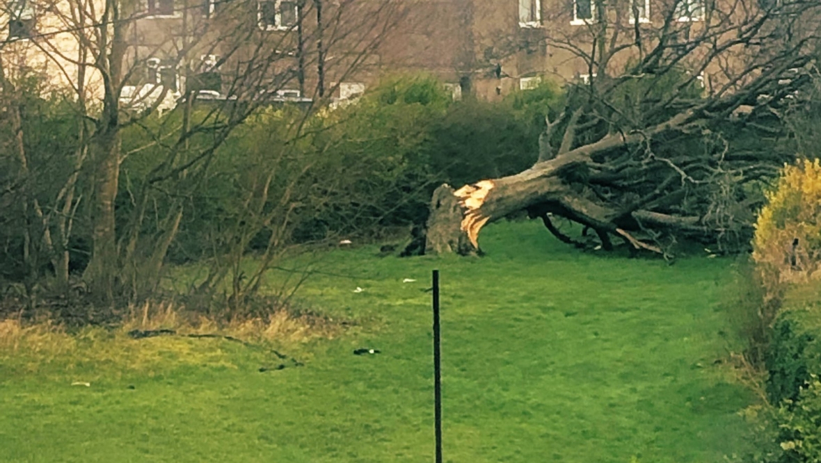 Supplied
Insight – Sean Batty
Over the past few days there’s been lots of fine-tuning of Storm Dudley’s track and intensity. On Friday last week it looked like a storm which would hit the same areas as Storm Corrie, and with the same ferocity of winds, up to 90mph. As time has gone on this has been tamed and shifted further south.
With Storm Dudley coming in this afternoon we now have much more certainty with gusts now and are expecting around 70mph in the likes of Islay, Kintyre, Arran, the Ayrshire coast and over the hills of South Lanarkshire and the Borders. Elsewhere in central and southern areas gusts will be 50-60mph for a time late afternoon and evening.
As Dudley moves in the North Sea on Wednesday night colder air will begin to move south with many of the showers turning wintry in the north.
Unusually the next named storm, Eunice, is just a few days after Dudley. Eunice will be a lot further south with the potential to become a very noteworthy event for England and Wales. Even though we miss the worst of the winds from Eunice, she will bring the risk of heavy snow and blizzards in southern Scotland on Friday morning. But like Dudley, a change in track a little north or south will make all the difference.
We’re now in the very unsettled phase of winter after a quiet start in December, and there’s no end in sight. Having had a look at the computer models for next week, I’d say there’s a chance of more named storms.
Follow STV News on WhatsApp
Scan the QR code on your mobile device for all the latest news from around the country