 Getty Images
All the main weather headlines and your social media timelines in the next few days will be full of Storm Goretti, which is set to bring heavy snow in places, torrential rain, and strong winds. But that’s in England and Wales.
For us in Scotland, this system robs some of the energy from the snowfall we’ve seen recently, particularly across the north east. That said, wintry weather isn’t done with us just yet — sleet and snow showers are expected to return to eastern parts of the country on Friday and Saturday, this time also affecting areas such as Fife, Edinburgh and the Borders too.
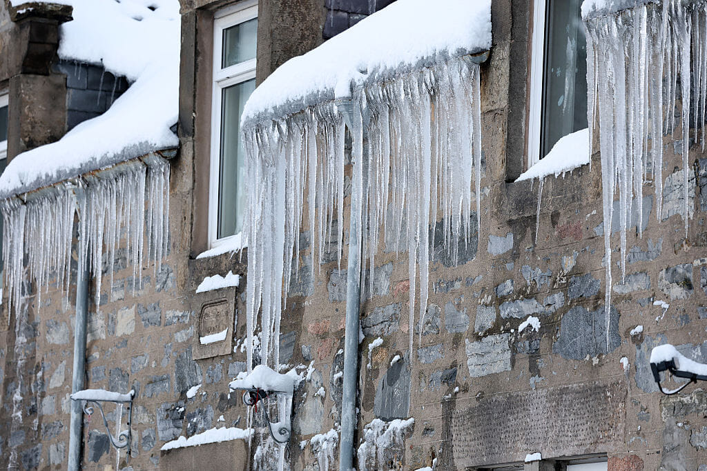
If you’re already fed up with the cold, brace yourself — for some places it’s about to get even colder. Overnight temperatures could fall below -15°C in parts of the Highlands, west Aberdeenshire and Perthshire over the coming nights, with Friday night likely to be the coldest.
A few computer models have even flirted with -20°C, which would be extremely rare and very much at the lowest end of what’s possible. While that’s unlikely to be officially recorded by Met Office stations, it gives a sense of just how cold the air mass currently is.
Now, if — like me — you’ve had no running water for days thanks to frozen pipes and you’re desperately waiting for a thaw, there is hope. By Sunday and Monday, a southerly airflow should begin to spread across the country, nudging temperatures upward. However, during this transition there’s a risk of another spell of snow, particularly across northern and eastern areas — probably the last thing many of you want.
This should be temporary though, as the milder air gradually wins out early next week. Before you get too excited, “milder” might be stretching it — “less cold” is perhaps a better description. Afternoon highs should reach around 4–6°C, though overnight frosts will still be possible. It’s an improvement on what we’ve endured this week, but still on the chilly side.
Now for the twist — and potentially the next story. Looking further ahead, there are signs the polar vortex could slow down again later this month. That increases the chance of blocking weather patterns developing, which could allow the cold air to return — possibly from the east this time.
At this stage it’s very uncertain, with only a handful of models hinting at this scenario, but if it does materialise it could bring another spell of very cold weather towards the end of the month and into February.
One possible outcome would be a large area of high pressure setting up over Scandinavia — something we don’t see all that often these days, but when it happens it can drag bitterly cold air out of Russia and into Europe, and sometimes reaches as far as the UK. A similar setup was responsible for the Beast from the East in 2018 — although that arrived in early spring, limiting its overall impact compared to what it could do in mid-winter.
So, in summary:
- Further wintry showers over the next few days
- Exceptionally cold nights ahead, possibly the coldest of this spell
- A chance of snow for many on Monday as less cold air moves in
- Beyond that, the outlook is uncertain, with a non-negligible risk of another significant cold spell later in the month
If you’re hoping for a dramatic warm-up, fully thawed pipes, and ice-free pavements… you may need a bit more patience. Stay warm out there.
Follow STV News on WhatsApp
Scan the QR code on your mobile device for all the latest news from around the country