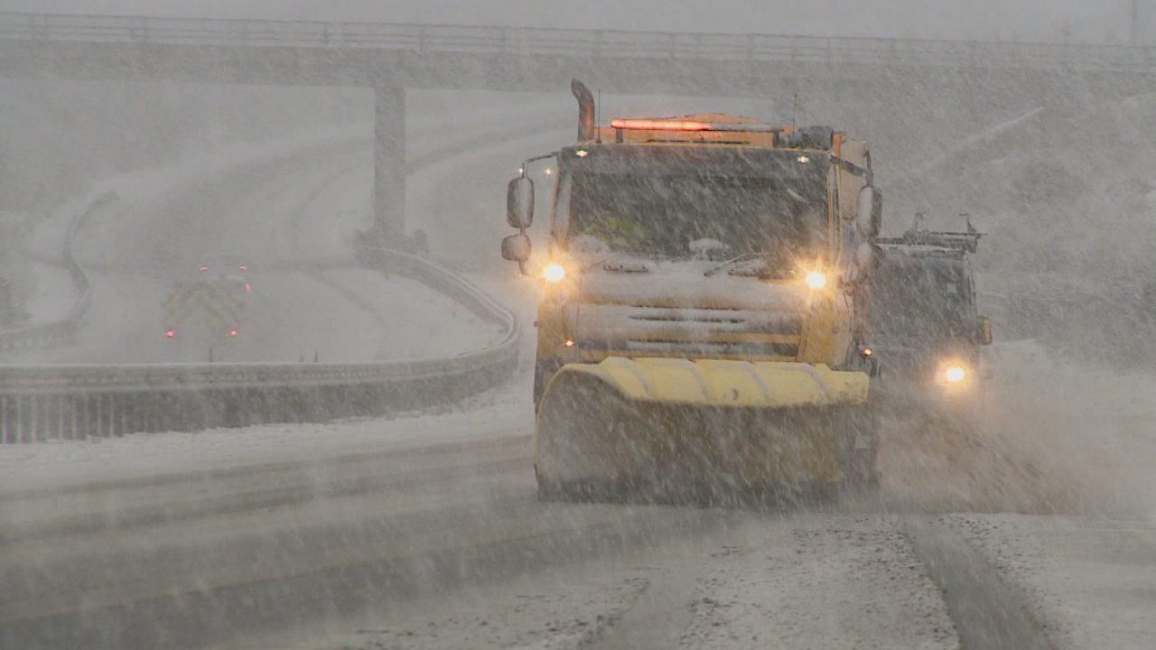
Parts of Scotland are set to be battered by downpours, heavy snow and strong winds as Storm Chandra hits the UK.
The Met Office has issued three weather warnings across the Western Isles, the Borders, the Lothians, Strathclyde, Grampian, Fife, Tayside and the Highlands for Tuesday.
Winds of between 50 to 60mph will strike Dumfries and Galloway, Argyll and Bute and South Ayrshire from 5am on Tuesday until shortly before midnight.
Drivers are warned of disruption on the road, while trains, flights and ferries are likely to be impacted.
The Lothians, Borders and Strathclyde have been issued a yellow alert for rain and snow between 12am and 5pm on Tuesday.
The regions will face between 20-30mm of rainfall with some place facing up to 50mm. Snow depth of up to 20cm is expected in high areas with between 2-5cm expected in lower parts.
Tayside, Fife, Grampian and the Highlands will face a similar yellow weather warning from 6am until midnight on Tuesday.
Residents have been told to expect longer journey times on road, bus and train journeys and that flooding is likely.
The latest weather warnings come a week after those living in Aberdeenshire, Perthshire and Angus faced significant disruption after they were battered by days of heavy rain.

Insight Sean Batty Weather presenter
The northern hemisphere has seen some extraordinary weather in recent weeks.
Record-breaking snowfall has hit parts of Russia and Japan, a huge and historic snowstorm has swept across the United States, and temperatures near the North Pole have hovered close to freezing – far above what’s normal for mid-winter.
Against that backdrop, it feels only fitting that the UK now has its own bout of severe weather in the shape of Storm Chandra, although for most of us, she will bring rain and strong winds rather than snow from Tuesday.
After a week of persistent rain and flooding across parts of Aberdeenshire, Perthshire and Angus, more rainfall is the last thing we need – but unfortunately it’s exactly what’s on the way.
The wettest conditions on Tuesday are again expected to affect Aberdeenshire, Angus, Perthshire and Stirlingshire, where 40–50mm of rain is possible. Similar totals are likely across the Borders, South Lanarkshire, South and East Ayrshire, and Dumfries and Galloway.
There will also be some snow, though mainly confined to higher ground above around 300 metres, keeping it clear of most of our villages. The heaviest snowfall will fall above 500 metres, where around 20cm is expected, with drifting and blizzard conditions making the mountains particularly hazardous on Tuesday.
This will provide another boost for the ski centres – especially Glenshee, The Lecht and Cairngorm, which has been digging itself out after some exceptional snowfall over the past week. The highest Munros in the south and east of the Grampians could see as much as 30–40cm of fresh snow.
The strongest winds associated with Storm Chandra will affect the west of the UK, from Cornwall through to the Hebrides.
An amber weather warning has been issued for Northern Ireland – one of the main reasons the storm has been named – where gusts could reach 75mph. In Scotland, the strongest winds are expected around Islay, Jura, Kintyre and coastal parts of Dumfries and Galloway on Tuesday afternoon, with gusts possibly reaching 60mph along exposed coasts.
Overall, the main concern for Chandra in Scotland is rainfall. Given that some areas saw over 100mm of rain in just a few days last week, there is a renewed risk of localised flooding, particularly on country roads.
Looking beyond Chandra, the outlook is not especially encouraging. A persistent south-easterly airflow is expected to remain in place until at least Sunday, which is bad news for Aberdeenshire and Angus, bringing further rain each day. While the rainfall may not be especially heavy at any one time, the cumulative totals could still cause problems and will need to be monitored closely.
On a more positive note, freezing levels are set to remain over the mountains, allowing further snowfall to accumulate at upper levels – particularly across the eastern ski resorts. With additional snow in the coming days, it’s possible that some mountain summits could end up with close to two metres of snow.
Follow STV News on WhatsApp
Scan the QR code on your mobile device for all the latest news from around the country