 Facebook
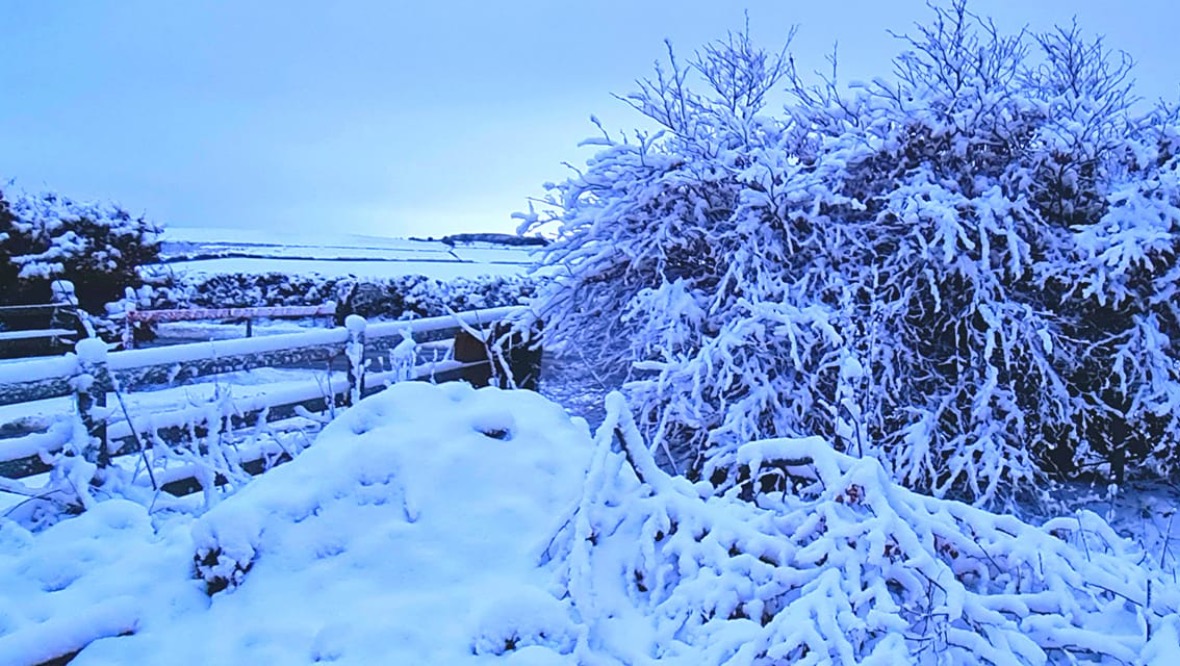
Parts of Scotland could be set for its ‘coldest conditions’ in more than ten years with heavy snowfall forecast for large parts of the country.
An amber weather warning for snow will be active from 3pm on Thursday until 6pm on Saturday with drivers being warned over hazardous conditions.
The Met Office warns that roads may become blocked by deep snow and communities ‘cut off for several days’.
Deeside is expected to be the worst hit area with places such as Kildrummy, Ballater, Balmoral, Braemar and Easter Ross seeing a high amount of snowfall by Sunday.
There are also three yellow weather warnings for snow for Thursday covering most of Scotland, meaning drivers risk becoming stranded and power cuts are possible.
A yellow warning for rain covering lower parts of the country will be in force until midday on Saturday, meaning localised flooding is likely.
The snow will become persistent and heavy over the weekend and could lead to some significant disruption.

STV meteorologist Sean Batty predicts parts of the country could see their snowiest and coldest conditions since 2010, and a very severe and dangerous situation could develop in parts of the north on Friday and Saturday.
He said: “We’ve had cold conditions for weeks now and it looks like that is going to continue and turn even more severe in the coming days.
“Not only could it be the coldest weather this season, but it could end up being our coldest conditions since December 2010.
“At the moment most of our snow is above 200m, with the biggest falls in the next 24 hours over the likes of the eastern end of the Southern Uplands, Fintry Hills and Ochils where 10-20cm may fall. In the southern and eastern end of the Grampians 20-30cm could accumulate on top of what we already have through Wednesday and Thursday.
“The main weather event comes in during the early hours of Friday until the end of Saturday with heavy snow expected, especially in higher parts, but also to lower levels later away from the east coasts.
“The worst areas will be Easter Ross, Moray, Aberdeenshire, Perthshire, Angus and perhaps higher parts of the Kinross area. Up to 15cm of snow is possible at low levels, but higher regions could get up to 30cm.
“With the easterly air flow I would expect western parts of Deeside and Donside to be particularly bad, alongside inland and upland parts of Easter Ross.”
Sean also warned drivers over dangerous conditions and urged anyone travelling on the roads to use caution.
He said: “I cannot stress enough how dangerous conditions could become on some of these roads later in the week and something that essential travellers will need to consider.
“The A939 and A93 have already got closed snow gates and I think it’ll be quite a long time before these are re-opened again, perhaps not until later next week.”
Mark Sidaway, Met Office deputy chief meteorologist, said: “Into the weekend, snow will continue across much of Scotland, and is likely to increasingly fall to low levels.
“We are likely to see some very large accumulations across higher parts of Scotland especially, with strong winds leading to significant drifting and blizzard conditions at times.”
Follow STV News on WhatsApp
Scan the QR code on your mobile device for all the latest news from around the country