Weather warnings have been issued as snow and freezing gusts of wind up to 75mph are to hit parts of northern Scotland causing disruption.
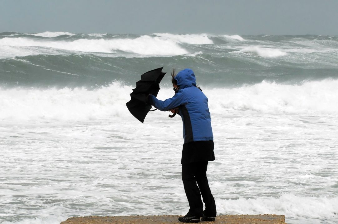
A yellow weather warning issued by the Met Office said that until 5pm on Wednesday strong southwestern winds will batter parts of north west Scotland, bringing with it travel disruptions and dangerous coastal conditions.
Gusts of 65mph to 70mph are expected quite widely, with some gusts around 75mph especially during a period of squally rain which will cross the area during the early afternoon.
Winds will ease considerably following the rain, but freezing conditions are set to follow.
The wind warning covers both the Highlands and Western Isles, while a second yellow weather warning for snow and ice will come into force at 4pm on Wednesday.
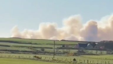
Travel is already disrupted as CalMac has announced the adverse weather conditions mean several sailings have been cancelled or could be subject to short notice cancellations.
Wintry showers will affect northern and western parts of Scotland from Wednesday afternoon lasting through the night.
The Met Office warned it will result in icy patches at low levels and some snow accumulations of 1cm to 2cm are possible above about 150m, with 2cm to 5cm above about 250m.
The warning for snow and ice will last until 9am on Thursday morning, and covers the Perth and Kinross, Stirling, Aberdeenshire, Moray, Highland, and Argyll and Bute areas.

Insight Sean Batty STV Meteorologist
We have a very active weather front coming south today which will bring three main things – a short spell of heavy rain, colder air, and gusty winds.
The strongest gusts will occur across Skye and the Western Isles this afternoon with peaks of around 70-75mph. Further south for the likes of Iona, Mull, Coll and Tiree gusts could reach around 60mph. As the front crosses the mainland later in the afternoon and this evening gusts will be in the order of 40-50mph.
As the colder air sweeps in quickly behind the rain band, heavy snow can be expected across the north Highlands this afternoon which could make travelling, especially on the A835, a little tricky.
The winds will slowly ease later in the night, although it will stay very windy in the north through tomorrow. Frequent wintry showers will also affect these areas and could lead to some ice on the roads.
Follow STV News on WhatsApp
Scan the QR code on your mobile device for all the latest news from around the country