Scots can expect frost, hail and the possibility of snow showers later in the week as a cold snap is set to hit parts of the country.
Areas including Orkney, Caithness Sutherland, Moray, Aberdeenshire and Angus are expected to be hit with potential snowfall by Wednesday afternoon.
According to STV Weather presenter Philip Petrie, a frontal system will begin to move in from the north, so by teatime Shetland and Orkney will start to see cloud thickening and a band of rain spreading in.
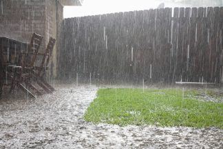
At the same time, this front will bring in much colder air stretching back to the Arctic, so overnight there is a chance that any lingering showers could feel quite wintry, with hail down to lower levels and on higher ground the chance of snow.
By the time most of the country are wakening up Thursday the frontal system will be south of the border, and we will be well under the influence of the cold arctic air.
It is around this time that a second frontal system moves in from the north, and again this will bring further showers that will feel quite wintry across the higher ground of Orkney, Caithness and Sutherland, parts of Moray, Aberdeenshire and stretching down to Angus.
Philip said: “Well we’ve started the new week fairly unsettled with a lot of low cloud, damp and murky conditions.
“At the same time though we are in a southerly airflow, so that is pulling in milder.
“If we track that air back it is originating from across the Azores, so this is helping to push our temperatures up a few degrees across Tuesday and Wednesday, possibly reaching highs of 17C for the likes of Inverness, Fort William and parts of the central belt.
“This is unseasonably mild for the time of year and in some spots will be 4C or 5C above the average.
“However come Thursday our wind direction does a complete 180 and we will then be in a northerly airflow, with colder conditions flooding down from the north.
“We’ll then be in an arctic airflow and it will be noticeable – not only do our temperatures drop but the freezing level will drop too meaning we could see some hail down to lower levels for the far north of the country, with snow too but restricted mostly to higher ground.
“Conditions will be cold enough for snow down to around 400-500m in any heavier showers.
“This is nothing out of the ordinary for Scotland for the time of year, and in fact Thursday and Friday look set to be some of the brighter days of the week for Scotland, however it will be noticeably colder.”
A Met Office forecaster said: “From Thursday, temperatures will fall below average for most, increasing the likelihood of snow over higher ground in the north.”
Follow STV News on WhatsApp
Scan the QR code on your mobile device for all the latest news from around the country