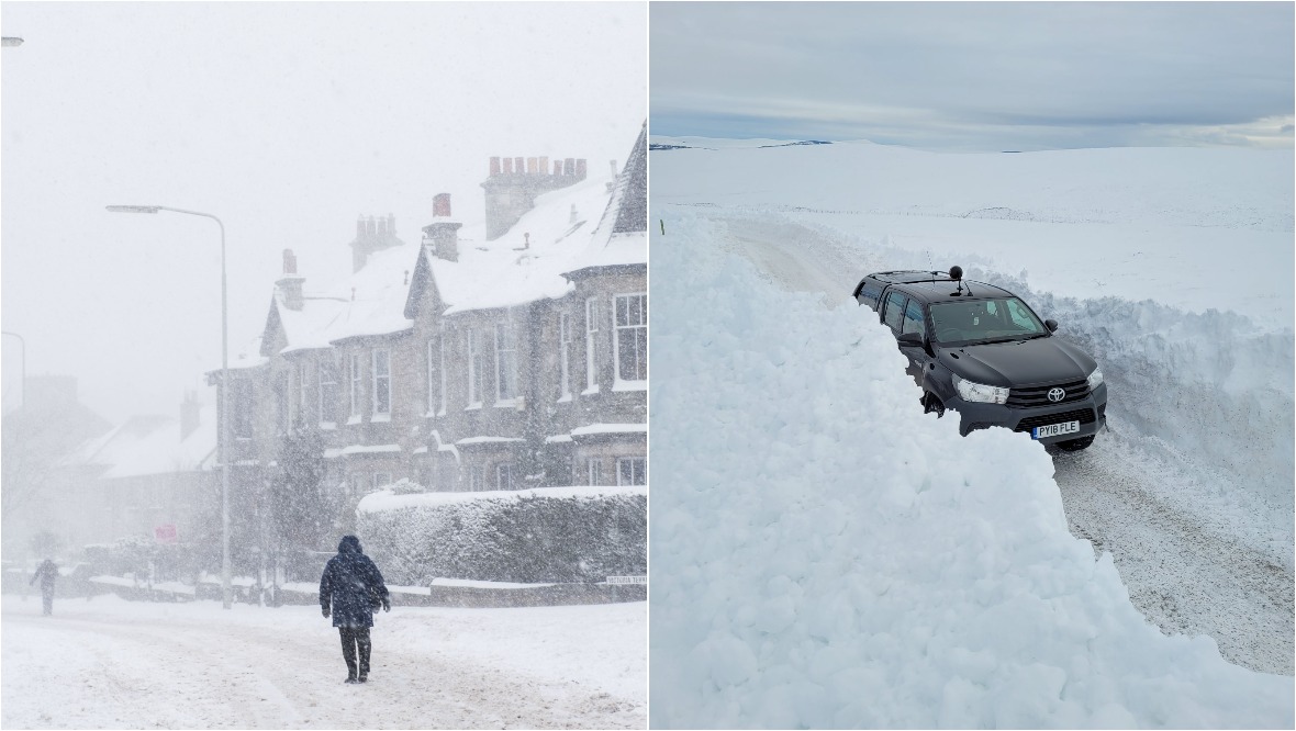
An amber weather warning has been issued as more heavy snow is set to hit parts of Scotland.
The Met Office alert will be in place from the early hours of Friday morning until 6pm on Saturday.
Deeside is expected to be the worst hit area with places such as Kildrummy, Ballater, Balmoral and Braemar seeing 60cm of snow by Sunday. Parts of Easter Ross will also get a huge amount of snowfall.
⚠️⚠️ Amber weather warning issued ⚠️⚠️
— Met Office (@metoffice) February 3, 2021
Snow across parts of Scotland
Friday 0000 – Saturday 1800
Heavy and persistent #snow is likely to lead to significant disruption to transport and utilities ❄️❄️
Latest info 👉 https://t.co/QwDLMfRBfs
Stay #WeatherAware⚠️⚠️ pic.twitter.com/457DOIILHw
Several yellow warnings for snow and ice have already been issued for areas in central, southern and northern parts of the country at the start of this week up until Monday evening.
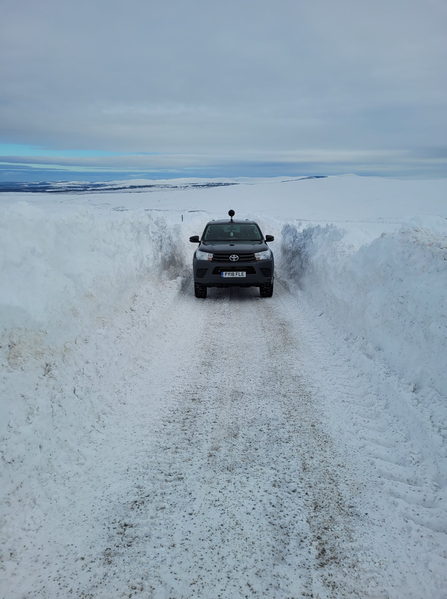 The Cawdor Estate
The Met Office predicts the snow will become persistent and heavy over the weekend and could lead to some significant disruption to transport.
Experts have warned of travel cancellations, road blocks and power cuts in the worst affected areas.
There is also concern that smaller communities may become cut off for several days due to the severe conditions.
STV Meteorologist Sean Batty predicts parts of the country could see their snowiest and coldest conditions for a few years, and a very severe and dangerous situation could develop in parts of the north on Friday and Saturday.
He said: “We’ve had cold conditions for weeks now and it looks like that is going to continue and turn even more severe in the coming days.
‘Not only could it be the coldest weather this season, but it could end up being our coldest conditions since December 2010.’
STV Meteorologist Sean Batty
“At the moment most of our snow is above 200m, with the biggest falls in the next 24 hours over the likes of the eastern end of the Southern Uplands, Fintry Hills and Ochils where 10-20cm may fall. In the southern and eastern end of the Grampians 20-30cm could accumulate on top of what we already have through Wednesday and Thursday.
“The main weather event comes in during the early hours of Friday until the end of Saturday with heavy snow expected, especially in higher parts, but also to lower levels later away from the east coasts.
“The worst areas will be Easter Ross, Moray, Aberdeenshire, Perthshire, Angus and perhaps higher parts of the Kinross area. Up to 15cm of snow is possible at low levels, but higher regions could get up to 30cm.
“With the easterly air flow I would expect western parts of Deeside and Donside to be particularly bad, alongside inland and upland parts of Easter Ross.
“In areas such as this we could approach 50cm of snow through the course of Friday and Saturday. Remember, this is in addition to the snow that will fall through Wednesday, Thursday and Sunday. All of this added together means some areas could have 70 plus centimetres of lying snow into next week.”
As well as the heavy snow, Sean said there will be a strong wind which will give blizzard conditions and drifting of the snow, especially on the higher roads.
He said: “I cannot stress enough how dangerous conditions could become on some of these roads later in the week and something that essential travellers will need to consider.
‘I expect that early next week we’ll experience our coldest weather of the winter so far with temperatures possibly around -15C or lower in some spots.’
STV Meteorologist Sean Batty
“The A939 and A93 have already got closed snow gates and I think it’ll be quite a long time before these are re-opened again, perhaps not until later next week.”
In central and southern Scotland there will mostly be icy rain and sleet in the next few days with the snow on higher ground. Through Friday the snow levels will drop and it’s possible snow will fall in these areas into the weekend.
Next week Scots will see high pressure extending in from Scandinavia which will bring a flow of even colder air allowing temperatures to plummet.
Sean added: “I expect that early next week we’ll experience our coldest weather of the winter so far with temperatures possibly around -15C or lower in some spots. Not only could it be the coldest weather this season, but it could end up being our coldest conditions since December 2010.
“With severe conditions ahead in some areas, it’s time to get prepared and stay up to date with the latest forecasts as things may change at short notice.”
Follow STV News on WhatsApp
Scan the QR code on your mobile device for all the latest news from around the country