I know, I know, you’re desperate to know where Storm Ellen is/ has been/ has gone – depending on what you think has happened to her.
Some of you may be slightly confused, she swung by last weekend, right? Wrong. You may remember last week I was talking about the potential for a weekend storm which would be unnamed. Well after tweeting about it, lots of people replied saying it was actually called Storm Ellen.
That, however, was a mix-up due to some of the press deciding to name it themselves, without it ever officially being named by the Met teams. This is one of the problems we have with issuing the names in advance – sometimes someone just takes it upon themselves to name an upcoming storm before anything has been done officially.
But does that matter? Well, yes in this case, it did, because the ‘storm’ came to nothing in the end as it didn’t really develop like some computer models were touting. So Met Eirann and the Met Office were right not to name it Ellen and worry people unnecessarily.
Something to confuse you more is we’ve got Storm Jorge (pronounced Horhay) on the way this weekend. But I hear you say, why then has the storm changed sex as it hurtles towards us with a set of castanets? Well that’s more down to timing. Met Eireann was considering this morning naming the storm Ellen, the next name on our joint list with the Irish service, but they were pipped to the post by the Spanish State Meteorological Agency. The Spanish met service is part of the south-west European storm naming group, along with France and Portugal. That means, like our partnership with the Irish, they have their own joint agreed list of yearly names they work through.
It’s convention that once a storm has been named by any country, that the name will then be passed on through other countries the track takes it, even though they might have their own list of storm names. It’s the same as when the National Hurricane Centre in Florida names tropical storms or hurricanes – we refer to them here as ‘ex tropical storm …’ rather than rename them when they cross the Atlantic and head towards us.
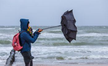
Now we’ve cleared that up, what does Jorge have in store for Scotland? Well in actual fact not too much. The storm centre is expected to currently track right over Scotland, which means most of us will have light winds. The strongest winds will be around the edges of the centre for Shetland and Orkney, Kintrye, Islay, and Dumfries and Galloway where gusts could reach up to 70mph along the coast.
The track may change which would give us much stronger winds, so keep an eye out for the latest information in the forecast. There will also be more rain moving north on Saturday, which, of course, because it’s a leap year will just add more to the rainfall totals of what has been a record-breaking wet month for some spots.
So Ellen remains on our list awaiting her moment…


