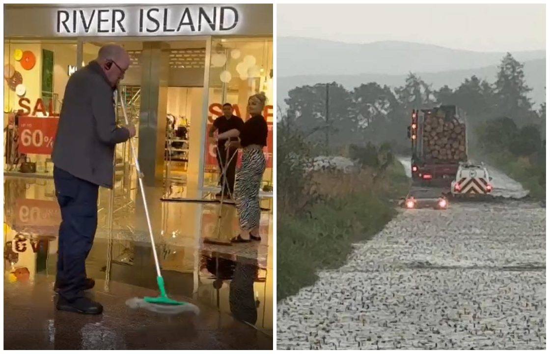
A shopping centre has been evacuated and cars have been submerged in floodwater as Scotland has been struck by heavy rain and thunderstorms.
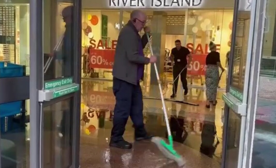
The manager of the Overgate in Dundee said it felt like “six months of rain fell in ten minutes”, as the city centre mall was evacuated due to flooding.
Stores on the ground floor of the shopping centre were affected, with a significant clear up operation under way. It is thought some stores may not reopen on Friday morning due to the damage.
Malcolm Angus, Overgate centre manager, said: “We have experienced what feels like six months of rain falling in ten minutes.
“Overgate’s drainage is connected to the city’s main drainage system. The city’s system has been overwhelmed, and as a result the sheer volume of water has come back into Overgate.
 STV News
“The ground floor of the mall, and every retailer from Vodafone down to Costa, is experiencing major flooding.
“A full evacuation has been made. The majority of stores are now closed and a significant clear-up operation is under way.
“Car parks are open for people who need to collect their cars. We anticipate that a number of stores may not be open for 9am tomorrow due to the scale of the clear-up.
“Please follow Overgate social media for updates when available.”
Meanwhile images were shared on social media on Thursday showing vehicles submerged in water between the villages of Logie, Coldstone and Dinnet in Aberdeenshire.
It comes after rainfall of 32.2mm in Tarland, 22.2mm in Aboyne and 13.6mm was recorded between midnight and 4pm.
A yellow alert for thunderstorms is in force throughout large parts of the country, warning of heavy downpours and strong winds.
While most areas will remain dry, scattered heavy showers and thundery weather could bring hail, lightning and surface water flooding, particularly in the central and eastern regions.
Further rainfall of up to 40mm in less than an hour is possible and some places could see up to 60mm of rain fall within an hour in isolated areas.


The Scottish Environment Protection Agency has issued 19 flood alerts.
Sudden flooding could bring disruption to travel on roads and rail, with ferry routes also expected to be disrupted.
The warning, which came into place at midnight, covers the whole of Scotland and will last until 10pm.
Showers and thunderstorms should slowly ease through the mid to late evening.
Amid the unsettled conditions, Scotland has recorded its second heatwave of the year, with temperatures reaching 31.1C in Charterhall in the Borders and 29.9C in Aviemore in the Highlands.
Dyce in Aberdeenshire recorded 25.4C at 2.46pm on Wednesday – eight degrees above average for the time of year – marking the second heatwave in Scotland so far this summer.
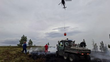
The Scottish Fire and Rescue Service has also issued its tenth wildfire warning of the year.
The public is being urged to avoid using naked flames outdoors until August 19.

Insight Philip Petrie STV weather presenter
Originally we started the week with high pressure in charge of our weather but today we have seen low pressure drifting across Scotland, bringing with it some instability to our weather. Combine that with the current hot conditions and that’s what has sparked off all our thunderstorms on Wednesday and the risk of thunderstorms on Thursday.
Come Friday though, we start to see high pressure building in from the Atlantic once again, and this will both help to settle things down in terms of our weather just in time for the weekend, but also cut off that southerly airflow that’s been pulling in the warmer air.
This means despite conditions becoming more settled, it will also be less warm than it has been.
Follow STV News on WhatsApp
Scan the QR code on your mobile device for all the latest news from around the country