A Nessie hunter has recorded the moment a ‘mini tornado’ appeared above hills near Loch Ness.
When it comes to the famous Loch, there is very little that Steve Feltham has not yet seen.
For the past 33 years he has been observing it closely, hunting for the ever-elusive Loch Ness monster, but what appeared above the nearby hills on that Monday afternoon has shocked even him.
“I have never seen anything like that here before; it was very sudden,” explains the Nessie hunter, who holds the Guinness World Record for the longest continuous vigil for the creature.
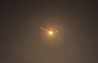
“It was roughly 2.30pm when I spotted it forming over the hills.
“There was no warning – it was one of those moments when you just grab your phone, start filming, and ask questions later,” Steve adds.
From his regular ‘observation post’ at Dores Beach, he had a prime view of what he, at the time, assumed to be a ‘mini tornado’.
“It was quite exciting; I did not know whether it was going to get bigger or whether it was going to move.”
The funnel cloud that Steve has seen increased in size and lasted around four minutes before disappearing as quickly as it had appeared.

Insight Sean Batty STV weather presenter
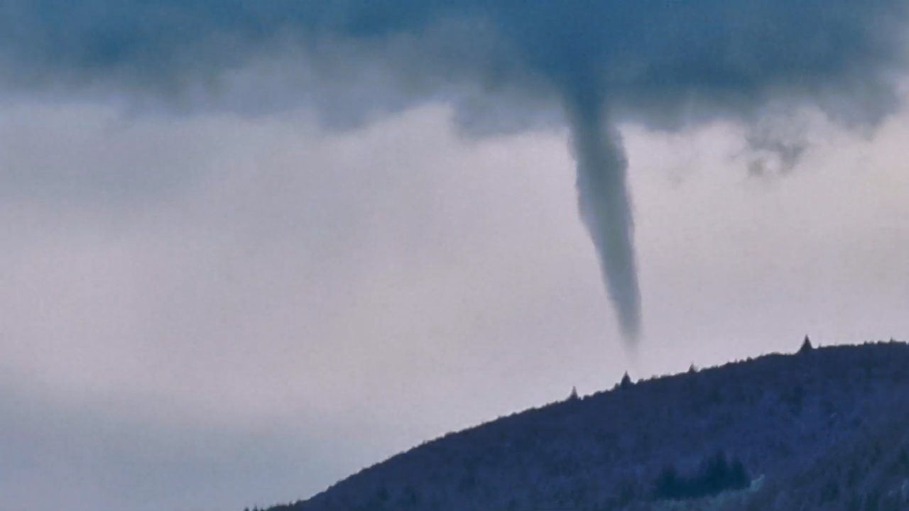
What we’ve observed near Loch Ness is a funnel cloud, not a tornado.
Tornadoes are rotating columns of air that make contact with the ground, whereas funnel clouds remain aloft with their rotating winds never reaching the surface.
The video shows a tightly formed funnel cloud with fast-moving winds maintaining its shape before it eventually dissipates.
In Scotland, sightings of funnel clouds are common each year, but tornadoes are rare.
Typically, a few tornadoes may occur annually, though they are usually weak and often happen in remote areas, leading to few reports.
Funnel clouds develop from cumulonimbus clouds, also known as thunderclouds.
They form when warm updrafts collide with cooler air within the cloud, creating turbulence that can cause the air to spin, resulting in a funnel cloud.
If this rotation intensifies, it can potentially develop into a tornado.
Follow STV News on WhatsApp
Scan the QR code on your mobile device for all the latest news from around the country