Key Points
-
 A Met Office yellow weather warning for thunderstorms was in force from 2am until 1pm
 - A house in Aviemore has caught fire after it was struck by lightning
- The Scottish Environment Protection Agency has issued 18 flood alerts.
- There have been more than 15,000 lightning strikes recorded in 24 hours
- The weather is expected to cause disruption on roads with difficult conditions and closures
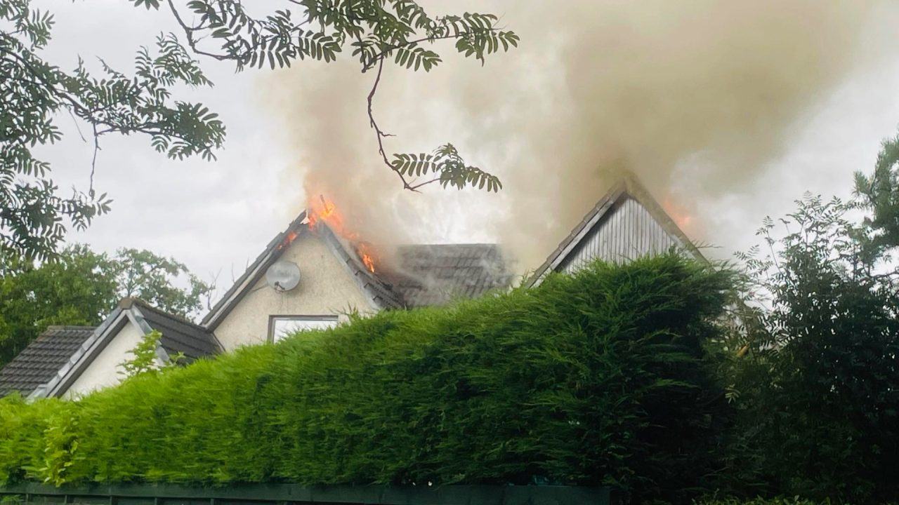
A family has managed to escape a fire after their home in Aviemore was struck by lightning.
Four appliances and a height vehicle were sent to a property on Grampian View following a lightning strike at around 10am on Monday.
There have been no reported casualties after neighbours witnessed the residents of the house escape.
Nick Forwood, local resident, said: “The family managed to get out.
Watch
‘House is completely devastated’
“And we were on the top of the road and it was just smoke to start with, but within 20 minutes, the flames were coming right through the roof and, as you can probably see, the house is completely devastated.”
It comes after more than 15,000 lightning strikes were recorded across the UK in the last 24 hours.
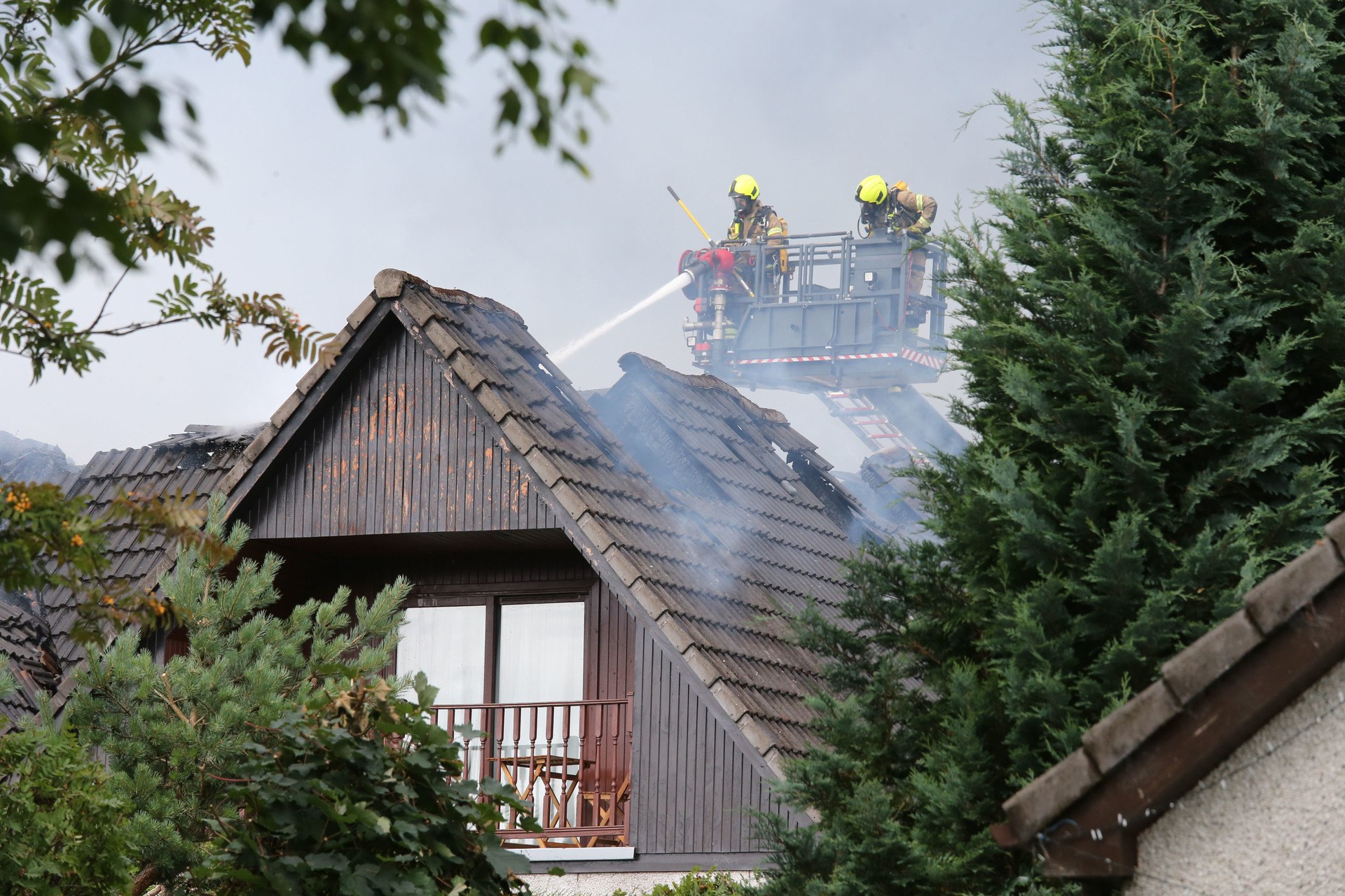 Northpix
Firefighters remain at the scene.
A Scottish Fire and Rescue Service spokesperson said: “We were alerted at 10am on Monday, 12 August, to reports of a dwelling fire following a lightning strike on Grampian View, Aviemore.
“Operations Control mobilised four appliances and a height vehicle, and firefighters remain on the scene.
“There were no reported casualties.”
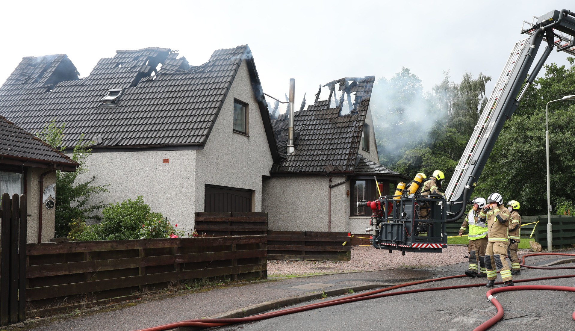 Northpix
A Met Office alert for thunderstorms started at 2am on Monday and was in effect until 1pm.
There have been more than 5,000 lightning strikes recorded in the 24 hours before 8am.

Insight Philip Petrie STV weather presenter
The week and weekend ended fairly fine thanks to high pressure that’s been dominating our weather, but things are quickly going downhill as we head into the new working week.
Overnight we saw a frontal system approaching from the west bringing with it cooler air. As that bumps up against the currently warmer air we have across the country, it will put us into a volatile air mass and spark off thunderstorms.
This is why the Met Office have issued the thunderstorm warning that came into effect at 2am on Monday morning and lasts until 1pm later in the afternoon.
The initial pulse of heavy and torrential rain comes through around rush hour which is likely to cause a lot of travel disruption and tricky conditions for people getting to work first thing. There will likely be a lot of surface water on the roads, flash flooding, and also frequent lightning strikes that could lead to power outages.
Most areas will see torrential downpours through the morning as the frontal system and band of rain crosses the country. Once it starts to clear eastward however we will start to see sunnier and drier conditions moving in from the west in the afternoon from around midday onwards.
Follow STV News on WhatsApp
Scan the QR code on your mobile device for all the latest news from around the country