 iStock
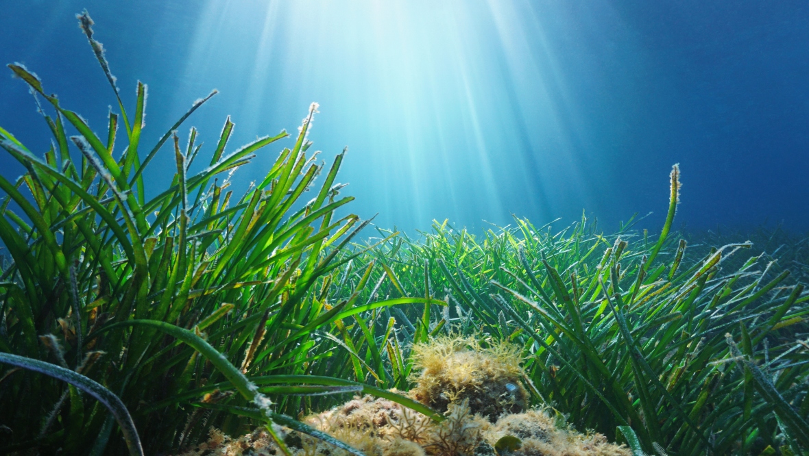
Environmental researchers have mapped a seagrass meadow over three million square feet for the first time in Orkney waters.
The bed was identified in the southern waters of Papa Westray using aerial and underwater drones as part of a project run jointly by Greenpeace UK and Scottish charity Open Seas.
Seagrass is the only flowering plant in the marine world and was once a common habitat around the coastline and throughout UK waters – but the population has dwindled in recent decades due to climate change and oceanic pollution.
A 2021 study described the decline of the marine plant in UK waters as “catastrophic”, with over 92% of the country’s historical seagrass meadows destroyed due to external factors.
They provide essential nursery grounds for marine life including seahorses, and develop on sandy and muddy substrate in intertidal, shallow waters in sheltered parts of the coast.
Seagrass beds are included in the Scottish Government’s Marine Protected Area Network, and are classed as a ‘Priority Marine Feature – with the country’s waters supporting 20% of north-west Europe’s seagrass population.
Phil Taylor, head of policy for Open Seas, said: “Seagrass is a carbon super-sequestrator and plays a hugely important role by binding sediments together and stabilising the seabed.
“Not only do they help prevent coastal erosion and mitigating the impacts of climate change, they also provide a fantastic nursery for juvenile fish and other marine life, and so are vital for the health of local fisheries and livelihoods.
The mapping project was undertaken after residents on the island reached out to Open Seas, with an interest in building knowledge about their local marine environment.
Researchers mapped the 30-hectare seagrass meadow aerially first, using drones to survey the area around Vest Ness.
After the aerial survey, researchers aboard a boat employed an underwater remotely operated vehicle (ROV) to confirm their findings.
Rohan Holt, Research Officer for Open Seas said: “For aerial surveys, it helps if the conditions are just right: low tide, not too much of a glare from the sun. It was a phenomenal couple of days. When we stitched the images together, we were really thrilled to see such a large seagrass bed. We estimate it to be a very significant 30 hectares.
“It is great to see local communities working to build knowledge about their local marine environment, and we are glad to contribute to the wider scientific seabed survey work in Orkney.”
Follow STV News on WhatsApp
Scan the QR code on your mobile device for all the latest news from around the country